


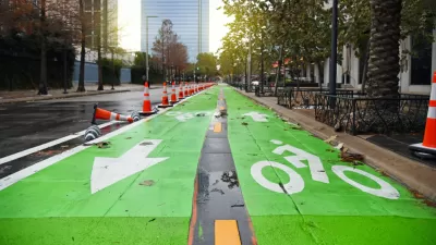
Community members, aided in part by funding from the city, repurposed a vehicle lane to create a protected bike and pedestrian path for the summer season.

A group of neighbors in Indianapolis led an effort to create a temporary multi-use path on the Calvary Street Bridge to illustrate the potential of bike- and pedestrian-oriented safety improvements.
As Jordan Smith reports in the Indianapolis Star, the project was spearheaded by community members from the Fletcher Place and Fountain Square neighborhoods and partially funded by the city. “The city contributed a $6,500 grant for the neighbors' "tactical urbanism" project through its Community Powered Infrastructure program, which matches dollars raised by local groups to improve roads, sidewalks and multi-use paths.”
“The two neighborhoods partnered this weekend to place more than 60 traffic barriers along the southernmost lane of the Calvary Street bridge, where the new path runs. They also painted the road and set up several new curb extensions to calm traffic along nearby McCarty Street.” The same community members have been monitoring traffic speeds on their local streets, which led to the addition of temporary curb bumpouts on some streets to slow traffic.
The current projects will last through October, when the city will need to use the space to operate snowplows. However, the neighbors involved hope to make the changes permanent next year.
FULL STORY: Indianapolis neighbors near I-65/I-70 South Split shut down lane for pedestrian path

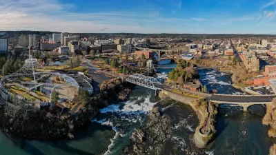
Spokane Launches Safe Streets Initiative
The Washington city received a $9.6 million federal grant to fund quick-build traffic calming and bike and pedestrian infrastructure projects.
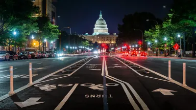
Safe Streets Funding in Jeopardy
The Trump administration is specifically targeting bike infrastructure and other road safety projects in its funding cuts.
Houston Mayor Pauses Complete Streets Projects
The move raises concerns among road safety advocates who point out that traffic deaths continue to rise.

Planetizen Federal Action Tracker
A weekly monitor of how Trump’s orders and actions are impacting planners and planning in America.

Restaurant Patios Were a Pandemic Win — Why Were They so Hard to Keep?
Social distancing requirements and changes in travel patterns prompted cities to pilot new uses for street and sidewalk space. Then it got complicated.

Map: Where Senate Republicans Want to Sell Your Public Lands
For public land advocates, the Senate Republicans’ proposal to sell millions of acres of public land in the West is “the biggest fight of their careers.”

Maui's Vacation Rental Debate Turns Ugly
Verbal attacks, misinformation campaigns and fistfights plague a high-stakes debate to convert thousands of vacation rentals into long-term housing.

San Francisco Suspends Traffic Calming Amidst Record Deaths
Citing “a challenging fiscal landscape,” the city will cease the program on the heels of 42 traffic deaths, including 24 pedestrians.

California Homeless Arrests, Citations Spike After Ruling
An investigation reveals that anti-homeless actions increased up to 500% after Grants Pass v. Johnson — even in cities claiming no policy change.
Urban Design for Planners 1: Software Tools
This six-course series explores essential urban design concepts using open source software and equips planners with the tools they need to participate fully in the urban design process.
Planning for Universal Design
Learn the tools for implementing Universal Design in planning regulations.
Heyer Gruel & Associates PA
JM Goldson LLC
Custer County Colorado
City of Camden Redevelopment Agency
City of Astoria
Transportation Research & Education Center (TREC) at Portland State University
Camden Redevelopment Agency
City of Claremont
Municipality of Princeton (NJ)