


A redesigned bus network in the Bronx, planned since October 2019, is now live.
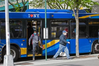
The Bronx Local Bus Network Redesign project, led by the New York Metropolitan Transportation Authority (MTA), launched on June 26 with new routes and service schedules, according to an article in Mass Transit magazine.
“The redesigned network brings foundational improvements that will deliver more reliable bus service, improve connections, reduce wait times and increase bus speeds. It reallocates resources to the portions of the borough with the greatest impact and lays out an adaptable framework to meet real-time travel patterns of current and future bus customers,” according to the article.
The article adds that the new system design responds to demographic and travel pattern changes in the borough in recent decades. “While service adjustments were made along the way, the redesign provides the larger-scale improvements needed to better meet the demand of today’s riders. The redesigned network consists of 13 significantly modified routes, two new routes and changes on most routes in respect to bus stops and schedules.”
The system's redesign focuses on a few key concepts, such as bus stop balancing (i.e., reducing the number of bus stops to increase bus speeds), more direct routes, better connections, and more all day service with higher bus frequencies.
More details of the redesigned network and the planning process led culminated over the weekend can be found on the Bronx Local Bus Network Redesign page on the MTA website.
FULL STORY: MTA set to launch redesigned Bronx Local Bus network

New York's Bus System Redesign—Delayed by the Pandemic—Moves Forward Again
A plan to redesign the bus system in New York City for faster, more frequent service is off the shelf and moving forward again after being paused at the beginning fo the pandemic.
Next Up for Bus System Redesign: Norfolk, Virginia
The Norfolk City Council will vote in February on a draft transit system redesign organized around the principle of a high frequency grid, similar to system redesigns in other cities in recent years.
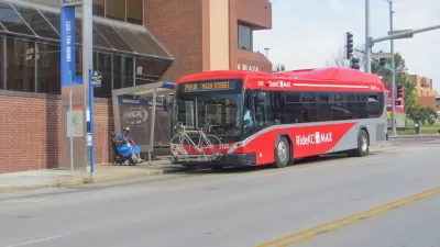
Draft RideKC Bus System Redesign Announced
The RideKC bus system is being redesigned on a high frequency grid.

Planetizen Federal Action Tracker
A weekly monitor of how Trump’s orders and actions are impacting planners and planning in America.

Congressman Proposes Bill to Rename DC Metro “Trump Train”
The Make Autorail Great Again Act would withhold federal funding to the system until the Washington Metropolitan Area Transit Authority (WMATA), rebrands as the Washington Metropolitan Authority for Greater Access (WMAGA).

The Simple Legislative Tool Transforming Vacant Downtowns
In California, Michigan and Georgia, an easy win is bringing dollars — and delight — back to city centers.

The States Losing Rural Delivery Rooms at an Alarming Pace
In some states, as few as 9% of rural hospitals still deliver babies. As a result, rising pre-term births, no adequate pre-term care and harrowing close calls are a growing reality.

The Small South Asian Republic Going all in on EVs
Thanks to one simple policy change less than five years ago, 65% of new cars in this Himalayan country are now electric.

DC Backpedals on Bike Lane Protection, Swaps Barriers for Paint
Citing aesthetic concerns, the city is removing the concrete barriers and flexposts that once separated Arizona Avenue cyclists from motor vehicles.
Urban Design for Planners 1: Software Tools
This six-course series explores essential urban design concepts using open source software and equips planners with the tools they need to participate fully in the urban design process.
Planning for Universal Design
Learn the tools for implementing Universal Design in planning regulations.
Smith Gee Studio
City of Charlotte
City of Camden Redevelopment Agency
City of Astoria
Transportation Research & Education Center (TREC) at Portland State University
US High Speed Rail Association
City of Camden Redevelopment Agency
Municipality of Princeton (NJ)