


A debate over how to protect the East River waterfront from Sandy-level flooding and storm damage has delayed the project as community activists decry the city's last-minute change of plans.
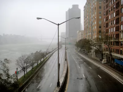
After Hurricane Sandy devastated Lower Manhattan in 2012, a federal grant competition sought out resilience projects that would protect East River Park and the surrounding neighborhood from future storms and flooding. A major recipient was a plan called the BIG U, which proposed natural barriers and berms that would allow occasional flooding and protect buildings. But rather than going ahead with the project, writes Michael Kimmelman, the city pulled the plug in 2018, citing cost concerns and proposing an alternate plan that would raise the coastline by adding more landfill instead.
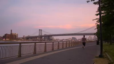
Kimmelman outlines the history of East River Park and the public housing developments dotting the East River waterfront, and describes the community activists working to develop resilience plans for the area. After years of public consultation, the city's decision to change the proposed plan at the last minute and disregard community input has led to a contentious debate over the future of the area. The controversy divided the community and slowed progress on essential infrastructure needed to protect local residents and buildings.
Kimmelman describes the situation as a tension between community input and perceived expertise, between the inclusion of all voices and the urgent need for flood mitigation measures. After multiple delays due to lawsuits, design changes, and the pandemic, the city is moving forward with its new plan, scheduled for completion in 2026. The new levee is projected to protect the neighborhood until 2050.
You can also listen to the article on The Daily podcast.
FULL STORY: What does it mean to save a neighborhood?

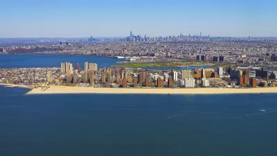
Planning for Resilience on Coney Island Creek
A case study in New York's response to the Hurricane Sandy flooding in the neighborhoods of Coney Island and Gravesend.
East River Floodgates Rising in NYC
A tour of new infrastructure designed to protect the city’s East Side from catastrophic flooding.

In Battery Park City, Public Infrastructure Meets Climate Resilience
A massive project underway in Lower Manhattan seeks to protect the shoreline from future flooding and mitigate the effects of climate change and rising sea levels.

Planetizen Federal Action Tracker
A weekly monitor of how Trump’s orders and actions are impacting planners and planning in America.

Restaurant Patios Were a Pandemic Win — Why Were They so Hard to Keep?
Social distancing requirements and changes in travel patterns prompted cities to pilot new uses for street and sidewalk space. Then it got complicated.

Map: Where Senate Republicans Want to Sell Your Public Lands
For public land advocates, the Senate Republicans’ proposal to sell millions of acres of public land in the West is “the biggest fight of their careers.”

Maui's Vacation Rental Debate Turns Ugly
Verbal attacks, misinformation campaigns and fistfights plague a high-stakes debate to convert thousands of vacation rentals into long-term housing.

San Francisco Suspends Traffic Calming Amidst Record Deaths
Citing “a challenging fiscal landscape,” the city will cease the program on the heels of 42 traffic deaths, including 24 pedestrians.

California Homeless Arrests, Citations Spike After Ruling
An investigation reveals that anti-homeless actions increased up to 500% after Grants Pass v. Johnson — even in cities claiming no policy change.
Urban Design for Planners 1: Software Tools
This six-course series explores essential urban design concepts using open source software and equips planners with the tools they need to participate fully in the urban design process.
Planning for Universal Design
Learn the tools for implementing Universal Design in planning regulations.
Heyer Gruel & Associates PA
JM Goldson LLC
Custer County Colorado
City of Camden Redevelopment Agency
City of Astoria
Transportation Research & Education Center (TREC) at Portland State University
Camden Redevelopment Agency
City of Claremont
Municipality of Princeton (NJ)