A tour of new infrastructure designed to protect the city’s East Side from catastrophic flooding.



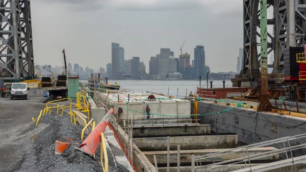
In an article for Curbed, Christopher Bonanos tours the waterfront on Manhattan’s East Side with Rohit Aggarwala, commissioner of the city’s Department of Environmental Protection and chief climate officer to better understand the flood defense mechanisms the city is installing.
The area was hard-hit by Hurricane Sandy, when water reached three blocks inland, destroying cars and basements. Now, the city is elevating East River Park and building a series of dikes and gates along the coastline north of the park. Bonanos points out that while the barriers are built to withstand storm surges, “They won’t be able to do anything about the immensely heavy rainstorms we’re now getting, including Ophelia, the storm we just had in late September.”
Aggarwala acknowledges that “The gates may be good for a century, but that figure depends somewhat on how many storms we get.” And while the designs may get backlash, “we’re going to lose something — whether it’s views, or a shorter walk to the water, or simply the ability to pretend we’re not up against the sea — because the world of the 22nd century is not going to look like ours.”
Read the full story: Walling Up the East Side to Save It


NYC’s Prospect Park is Getting a $68 Million ‘Bluebelt’
The city plans to upgrade the park’s drainage infrastructure to channel more stormwater into its lake and other drainage ponds and reduce flooding risk.
New York Flood Control Plan Takes Lessons From the Dutch
The Netherlands has a long history of flood mitigation. U.S. cities, threatened by coastal flooding and erosion, are taking note.

Net Zero Development Coming to New York City
The project, which relies largely on geothermal energy to minimize its carbon footprint, will bring affordable housing and boost storm resilience to an area devastated by Hurricane Sandy.

Planetizen Federal Action Tracker
A weekly monitor of how Trump’s orders and actions are impacting planners and planning in America.

California plans to bury El Niño’s downpour
If the state plays its cards right, it may be able to store a billion acre-feet of El Niño’s water in aquifers.

Chicago breaks ground on $3 billion megadevelopment
The new neighborhood, titled Foundry Park, will one day host 3,700 residences.

California High-Speed Rail Authority CEO resigns after $600,000 scandal
Under Ian Choudri, the authority used taxpayer dollars to fund first class flights and trips to nightclubs.

Want to study the Missouri River? Soon, you may need unanimous approval from 10 states
Legislation would require 10 governors’ permission to study or build projects moving water outside the basin.

Desperate measures: Advocates weigh draining Lake Powell to fill Colorado River
Draining the reservoir could reduce evaporation losses by a couple hundred thousand acre-feet.

FREE Course: Walkable City 1: Why Walkability?
After describing his path towards focusing on walkability as the essence of good planning, Jeff Speck marches through his five principal reasons for making more walkable places.
Reinventing Malls: Planning Alchemy—Turning Gray Fields Into Gold
The course focuses on the opportunities and imperatives that shape reinvention of mall sites.

City of Rosemead
Rutgers University, Edward J. Bloustein School of Planning and Public Policy
One Hundred Miles
Hunter College, City University of New York (CUNY)
The Architects Foundation
University of Cincinnati Online
City of Cambridge
Montrose County
The Pocatello Development Authority