


A case study in New York's response to the Hurricane Sandy flooding in the neighborhoods of Coney Island and Gravesend.
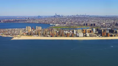
The New York Economic Development Corporation recently announced its release of the Coney Island Creek Resiliency Study, described as "a critical component to resiliency planning for the communities around Coney Island Creek."
"During Hurricane Sandy, Coney Island Creek was the main source of inundation for much of the Gravesend and Coney Island neighborhoods. Low edges and topography contributed to 'backdoor' flooding that caused enormous damage," according to the announcement.
The "study investigated several strategies to mitigate upland flooding, improve waterfront open space, strengthen neighborhood connections, enhance infrastructure, and provide opportunity for economic development around the Creek." A key finding of the study was the tie continued plans to study and plan for flood risk along the creek into broader regional efforts by the city and states of New York, along with the United States Army Corps of Engineers.
FULL STORY: Coney Island Creek Resiliency Study

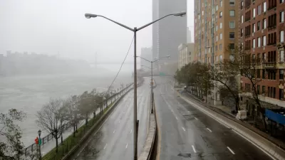
Saving Lower Manhattan
A debate over how to protect the East River waterfront from Sandy-level flooding and storm damage has delayed the project as community activists decry the city's last-minute change of plans.

In Battery Park City, Public Infrastructure Meets Climate Resilience
A massive project underway in Lower Manhattan seeks to protect the shoreline from future flooding and mitigate the effects of climate change and rising sea levels.
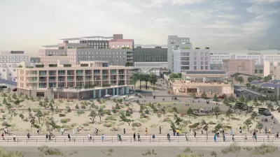
Net Zero Development Coming to New York City
The project, which relies largely on geothermal energy to minimize its carbon footprint, will bring affordable housing and boost storm resilience to an area devastated by Hurricane Sandy.

Planetizen Federal Action Tracker
A weekly monitor of how Trump’s orders and actions are impacting planners and planning in America.

Chicago’s Ghost Rails
Just beneath the surface of the modern city lie the remnants of its expansive early 20th-century streetcar system.

San Antonio and Austin are Fusing Into one Massive Megaregion
The region spanning the two central Texas cities is growing fast, posing challenges for local infrastructure and water supplies.

Since Zion's Shuttles Went Electric “The Smog is Gone”
Visitors to Zion National Park can enjoy the canyon via the nation’s first fully electric park shuttle system.

Trump Distributing DOT Safety Funds at 1/10 Rate of Biden
Funds for Safe Streets and other transportation safety and equity programs are being held up by administrative reviews and conflicts with the Trump administration’s priorities.

German Cities Subsidize Taxis for Women Amid Wave of Violence
Free or low-cost taxi rides can help women navigate cities more safely, but critics say the programs don't address the root causes of violence against women.
Urban Design for Planners 1: Software Tools
This six-course series explores essential urban design concepts using open source software and equips planners with the tools they need to participate fully in the urban design process.
Planning for Universal Design
Learn the tools for implementing Universal Design in planning regulations.
planning NEXT
Appalachian Highlands Housing Partners
Mpact (founded as Rail~Volution)
City of Camden Redevelopment Agency
City of Astoria
City of Portland
City of Laramie