


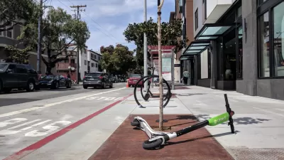
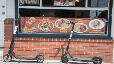
Years after cities first started trying to regulate electric scooters with geofences and designated parking areas, Bird will begin automatically lowering scooter speeds in pedestrian-dense areas like school zones and hospitals.

As Shannon Connellan reports, Bird is instituting "Community Safety Zones, geofenced areas of high-pedestrian activity clearly marked in the app's map" where "your maximum speed will be automatically reduced to 8 miles per hour." This "much-needed move" will first apply in busy areas such as schools and hospitals "in Miami, Marseille, and Madrid first, then expanding to the other 250 cities where Bird is available." The change follows "the long-studied dangers of riding e-scooters for riders and pedestrians — e-scooter related injuries are no joke, and that significantly goes for pedestrians. Bird's e-scooters' top speeds range from 16 miles (25 kilometres) per hour for the Bird Air to 18 miles (28 kilometres) per hour for the Bird One."
This is "the latest safety push from Bird, with the company recently making it harder to scoot under the influence with its 'Safe Start' feature. Launched in July, the feature makes users wanting to access scooters in late-night hours have to pass a keyword typing test to avoid scooting after drinking."
Years after Bird disrupted the shared mobility industry with "dockless" scooters that skirted city regulations, Jenn Fox of the Vision Zero Network, a worldwide road traffic safety campaign, says "Bird’s Safe Start and Community Safety Zones are an example of technology initiatives that can support safe systems, respond to community concerns and solve mobility challenges at the same time."
FULL STORY: Bird will slow your e-scooter down in high-pedestrian areas like schools

Scooter Companies Convene Advisory Groups to Promote Safety
Both Bird and Lime have organized boards of experts to conduct research and advise the companies as their micromobility ventures grow.
More Rights, Fewer Responsibilities, for Electric Scooter Riders in California
A bill that would toss the helmet requirement for adult e- scooter riders and allow them to ride on roads where the speed limit is 35 mph, up from the current limit of 25 mph, is on Governor Jerry Brown's desk. He has until Sept. 30 to decide.

Vehicle-related Deaths Drop 29% in Richmond, VA
The seventh year of the city's Vision Zero strategy also cut the number of people killed in alcohol-related crashes by half.

Planetizen Federal Action Tracker
A weekly monitor of how Trump’s orders and actions are impacting planners and planning in America.

Restaurant Patios Were a Pandemic Win — Why Were They so Hard to Keep?
Social distancing requirements and changes in travel patterns prompted cities to pilot new uses for street and sidewalk space. Then it got complicated.

Map: Where Senate Republicans Want to Sell Your Public Lands
For public land advocates, the Senate Republicans’ proposal to sell millions of acres of public land in the West is “the biggest fight of their careers.”

Orange County, Florida Adopts Largest US “Sprawl Repair” Code
The ‘Orange Code’ seeks to rectify decades of sprawl-inducing, car-oriented development.

Maui's Vacation Rental Debate Turns Ugly
Verbal attacks, misinformation campaigns and fistfights plague a high-stakes debate to convert thousands of vacation rentals into long-term housing.

San Francisco Suspends Traffic Calming Amidst Record Deaths
Citing “a challenging fiscal landscape,” the city will cease the program on the heels of 42 traffic deaths, including 24 pedestrians.
Urban Design for Planners 1: Software Tools
This six-course series explores essential urban design concepts using open source software and equips planners with the tools they need to participate fully in the urban design process.
Planning for Universal Design
Learn the tools for implementing Universal Design in planning regulations.
Heyer Gruel & Associates PA
JM Goldson LLC
Custer County Colorado
City of Camden Redevelopment Agency
City of Astoria
Transportation Research & Education Center (TREC) at Portland State University
Camden Redevelopment Agency
City of Claremont
Municipality of Princeton (NJ)