


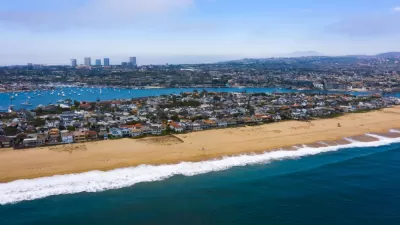
Over 80% of Californians live within an hour’s drive of a beach, but that does not mean that everyone has easy access to beaches.
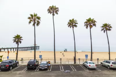
Beaches are some of California and Los Angeles County's most popular and beloved destinations. But not everyone can get to or enjoy them equally. As Frank Shyong reports in this article, there are numerous factors that contribute to inequitable beach access, including (but not limited to):
- Lack of public transit service to some beaches
- Lack of direct connections to some beaches via public transit, requiring transfers and use of multiple bus lines or modes of transportation
- Costs of parking, food, and activities
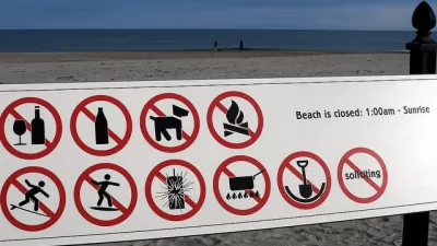
- Actions by some coastal homeowners, including putting up fake no-parking signs, painting curbs red, installing their own gates and staircases and hiring private security
- Racial bias and the lingering effects of the coast's history of segregation
The article also references a recent study by UCLA's Institute of Environment and Sustainability which offers some valuable data and recommendations regarding coastal access.
On a related note, the Los Angeles County Department of Parks and Recreation (DPR) is currently working on a study to analyze and document the need for facilities like beaches, natural areas, open spaces, regional parks, trails, and local parks in rural areas. As part of this process, DPR is conducting an online survey to better understand whether and how L.A. County residents are using these facilities.
FULL STORY: The beach is there for all of us — we just have to get there

Beachfront Residences Can't Extend Yards Onto Public Beaches, CA Coastal Commission Decides
"It's like squatting by the rich," said one commissioner.
Landowners Restrict Access to California Beach
A homeowners group has successfully moved to severely limit public access to the beaches of Hollister Ranch, a 14,500-acre parcel to the west of Santa Barbara.
Getting Creative to Reduce (or Increase) Beach Access
Communities and municipalities have deployed a surprisingly creative menu of policies to increase or restrict access to beaches. The Public trust doctrine, it turns out, is in the eye of the beach-holder.

Planetizen Federal Action Tracker
A weekly monitor of how Trump’s orders and actions are impacting planners and planning in America.

Map: Where Senate Republicans Want to Sell Your Public Lands
For public land advocates, the Senate Republicans’ proposal to sell millions of acres of public land in the West is “the biggest fight of their careers.”

Restaurant Patios Were a Pandemic Win — Why Were They so Hard to Keep?
Social distancing requirements and changes in travel patterns prompted cities to pilot new uses for street and sidewalk space. Then it got complicated.

Albuquerque Route 66 Motels Become Affordable Housing
A $4 million city fund is incentivizing developers to breathe new life into derelict midcentury motels.

DC Area County Eliminates Bus Fares
Montgomery County joins a growing trend of making transit free.

Platform Pilsner: Vancouver Transit Agency Releases... a Beer?
TransLink will receive a portion of every sale of the four-pack.
Urban Design for Planners 1: Software Tools
This six-course series explores essential urban design concepts using open source software and equips planners with the tools they need to participate fully in the urban design process.
Planning for Universal Design
Learn the tools for implementing Universal Design in planning regulations.
Heyer Gruel & Associates PA
JM Goldson LLC
Custer County Colorado
City of Camden Redevelopment Agency
City of Astoria
Transportation Research & Education Center (TREC) at Portland State University
Camden Redevelopment Agency
City of Claremont
Municipality of Princeton (NJ)