


Traditionally associated with its wide-open spaces, Texas is now, undeniably, defined by the cities and suburbs that comprise its built environment.
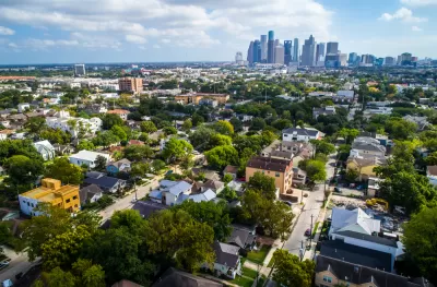
Three institutions—the LBJ School of Public Affairs at UT Austin, the SMU-Bush Institute Economic Growth Initiative in Dallas, and the Kinder Institute for Urban Research at Rice University in Houston—issued a "metropolitan blueprint" for the state of Texas. The blueprint is the first of its kind, as is the collaboration.
The key assumption underlying the blueprint is that the state is now defined by its developed places. "[C]ities and suburbs are Texas these days," reads an article by William Fulton announcing the report.
The report, therefore, offers a "road map that will move Texas toward a prosperous and successful metropolitan future" by challenging the status quo of business friendly policies and sprawling development patterns.
Before the pandemic emptied out urban business districts, Texas’ cities and suburbs had become notorious for their traffic congestion. Travel between the nodes of the Texas Triangle is time-consuming and inefficient. Governor Greg Abbott has acknowledged that road-building alone can no longer suffice to meet the state’s transportation needs.
The metropolitan prescription offered by the blueprint focuses into three key recommendations: 1) Texas should invest in Texans, 2) Texas should empower local communities, and 3) Texas needs solutions that are Texan. The report also focuses on three key areas: 1) Economic Development, 2) Housing and Land Use, and 3) Transportation and Infrastructure.
For additional reading on the blueprint—its conclusions, assumptions, and recommendations—see also an opinion piece written by Fulton, Kyle Shelton, Steven Pedigo, and J.H.Cullum Clark that's behind the paywall at the Houston Chronicle.
FULL STORY: A blueprint for continued economic prosperity in Texas

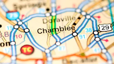
700 Homes Added to a Quickly Growing Corner of the Atlanta Metro Area
The Chamblee City Council has approved a massive new development project that will add more than 700 homes and tens of thousands of square feet of retail to the quickly growing city.
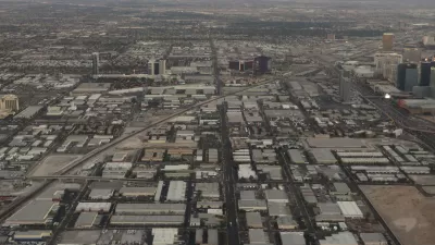
Cities in the South and West Keep Sprawling
New suburbs continue to expand into previously undeveloped areas, putting strain on local resources.
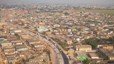
Report: Sprawl Threatens to Swallow the Planet
By 2030, cities will have tripled in size since 2000. Unmanaged, incessant growth is threatening the planet, according to a new report from the World Resources Institute.

Planetizen Federal Action Tracker
A weekly monitor of how Trump’s orders and actions are impacting planners and planning in America.

Map: Where Senate Republicans Want to Sell Your Public Lands
For public land advocates, the Senate Republicans’ proposal to sell millions of acres of public land in the West is “the biggest fight of their careers.”

Restaurant Patios Were a Pandemic Win — Why Were They so Hard to Keep?
Social distancing requirements and changes in travel patterns prompted cities to pilot new uses for street and sidewalk space. Then it got complicated.

Platform Pilsner: Vancouver Transit Agency Releases... a Beer?
TransLink will receive a portion of every sale of the four-pack.

Toronto Weighs Cheaper Transit, Parking Hikes for Major Events
Special event rates would take effect during large festivals, sports games and concerts to ‘discourage driving, manage congestion and free up space for transit.”

Berlin to Consider Car-Free Zone Larger Than Manhattan
The area bound by the 22-mile Ringbahn would still allow 12 uses of a private automobile per year per person, and several other exemptions.
Urban Design for Planners 1: Software Tools
This six-course series explores essential urban design concepts using open source software and equips planners with the tools they need to participate fully in the urban design process.
Planning for Universal Design
Learn the tools for implementing Universal Design in planning regulations.
Heyer Gruel & Associates PA
JM Goldson LLC
Custer County Colorado
City of Camden Redevelopment Agency
City of Astoria
Transportation Research & Education Center (TREC) at Portland State University
Camden Redevelopment Agency
City of Claremont
Municipality of Princeton (NJ)