


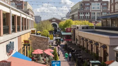
Peter Calthorpe's case study of El Camino Real in the Silicon Valley shows the potential for affordable housing development in the land surrounding side right-of-ways.

In an analysis of parcels adjacent to the El Camino Real right-of-way (ROW), a vast commercial corridor spanning 43 miles in California's Silicon Valley, Peter Calthorpe found a tremendous opportunity for affordable housing development. According to Calthorpe's research, presented here by Robert Steutville, 20% of parcels along the ROW could be used for multifamily housing to support 250,000 additional units. Silicon Valley currently faces a shortage of 600,000 housing units.
"Better use of the 120-foot ROW would convert the current six-lane thoroughfare to one that includes bus rapid transit (BRT), generous sidewalks, and bicycle lanes—while retaining six lanes of through traffic," writes Steutville.
The case study showed a staggering capacity for residential and mixed-use buildings and bus rapid transit. "I think there is something better in the future than straight BRT, which is slow. It is the most affordable and equitable that we can get to right now. But there are autonomous buses coming from China, which will reduce operating expense," says Calthorpe.
Calthorpe sees affordable land to be among the key advantages of increasing housing in cities. Moreover, the adoption of tax increment financing (TIF) could "pay for transit, enhanced parks and schools, and to subsidize 20 percent inclusionary zoning," according to Calthorpe.
FULL STORY: The corridor model for more affordable housing


A Critical Review of "Sick City: Disease, Race, Inequality and Urban Land"
Patrick Condon's new book, "Sick City: Disease, Race, Inequality and Urban Land" recommends tax reforms and housing subsidies to create more affordable and inclusive communities. It is attractive propaganda that deserves critical analysis.
How Atlanta Plans to Overhaul Zoning for Housing Affordability
The "Atlanta City Design: Housing" initiative is one of the most ambitious planning reform efforts of any large U.S. city, but it's just getting started.
Amazon and Other Tech Giants Make Billion-Dollar Commitments to Affordable Housing
Some of the world's biggest companies are investing in affordable housing, hoping to stymie the growing crisis their growth has contributed to.

Planetizen Federal Action Tracker
A weekly monitor of how Trump’s orders and actions are impacting planners and planning in America.

Restaurant Patios Were a Pandemic Win — Why Were They so Hard to Keep?
Social distancing requirements and changes in travel patterns prompted cities to pilot new uses for street and sidewalk space. Then it got complicated.

Map: Where Senate Republicans Want to Sell Your Public Lands
For public land advocates, the Senate Republicans’ proposal to sell millions of acres of public land in the West is “the biggest fight of their careers.”

Maui's Vacation Rental Debate Turns Ugly
Verbal attacks, misinformation campaigns and fistfights plague a high-stakes debate to convert thousands of vacation rentals into long-term housing.

San Francisco Suspends Traffic Calming Amidst Record Deaths
Citing “a challenging fiscal landscape,” the city will cease the program on the heels of 42 traffic deaths, including 24 pedestrians.

California Homeless Arrests, Citations Spike After Ruling
An investigation reveals that anti-homeless actions increased up to 500% after Grants Pass v. Johnson — even in cities claiming no policy change.
Urban Design for Planners 1: Software Tools
This six-course series explores essential urban design concepts using open source software and equips planners with the tools they need to participate fully in the urban design process.
Planning for Universal Design
Learn the tools for implementing Universal Design in planning regulations.
Heyer Gruel & Associates PA
JM Goldson LLC
Custer County Colorado
City of Camden Redevelopment Agency
City of Astoria
Transportation Research & Education Center (TREC) at Portland State University
Camden Redevelopment Agency
City of Claremont
Municipality of Princeton (NJ)