


The historic job losses of the past two months have hit the most vulnerable workers harder than others, so far. The Urban Institute estimated and mapped where more low-income jobs have been lost.
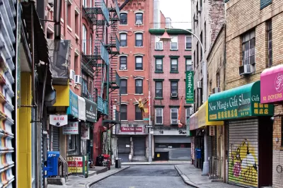
"The neighborhoods hardest hit by COVID-19 job losses are home to workers in industries like tourism and transportation, which are bearing the brunt of the economic shutdown," according to an interactive mapping project recently published by the Urban Institute. The project estimates the number of low-income jobs lost, and jobs at risk, by residents in each census tract or are at risk when stay-at-home orders are in place.
Check out the entire map of the country for a broad picture of the geography of the unemployment crisis, or zoom into the Census tract, level, as promised, for a more granular understanding.
For more on the geography of occupations, and the imbalance of economic effect during the pandemic, see also analysis by Jonathan Stiles published on Planetizen earlier this month.
FULL STORY: Where Low-Income Jobs Are Being Lost to COVID-19


The Geographic Disparities of Pandemic Unemployment
Neighborhood level unemployment data estimates reveal the deepening social inequality of the current economic crisis.
Surveying the Fiscal Nightmare for Cities and States
Governing takes a tour through the fiscal impacts of a suddenly cratered economy and an ongoing public health crisis.

Early Economic Effects of COVID-19 Concentrated in Large Metros
Big cities suffered the worst economic effects if the pandemic as of March, according to April data from the U.S. Bureau of Labor Statistics.

Planetizen Federal Action Tracker
A weekly monitor of how Trump’s orders and actions are impacting planners and planning in America.

Map: Where Senate Republicans Want to Sell Your Public Lands
For public land advocates, the Senate Republicans’ proposal to sell millions of acres of public land in the West is “the biggest fight of their careers.”

Restaurant Patios Were a Pandemic Win — Why Were They so Hard to Keep?
Social distancing requirements and changes in travel patterns prompted cities to pilot new uses for street and sidewalk space. Then it got complicated.

Platform Pilsner: Vancouver Transit Agency Releases... a Beer?
TransLink will receive a portion of every sale of the four-pack.

Toronto Weighs Cheaper Transit, Parking Hikes for Major Events
Special event rates would take effect during large festivals, sports games and concerts to ‘discourage driving, manage congestion and free up space for transit.”

Berlin to Consider Car-Free Zone Larger Than Manhattan
The area bound by the 22-mile Ringbahn would still allow 12 uses of a private automobile per year per person, and several other exemptions.
Urban Design for Planners 1: Software Tools
This six-course series explores essential urban design concepts using open source software and equips planners with the tools they need to participate fully in the urban design process.
Planning for Universal Design
Learn the tools for implementing Universal Design in planning regulations.
Heyer Gruel & Associates PA
JM Goldson LLC
Custer County Colorado
City of Camden Redevelopment Agency
City of Astoria
Transportation Research & Education Center (TREC) at Portland State University
Camden Redevelopment Agency
City of Claremont
Municipality of Princeton (NJ)