


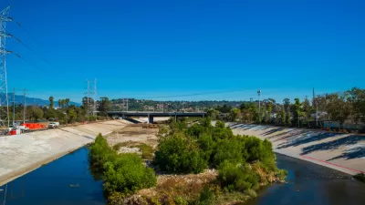
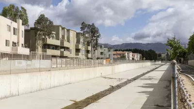
Regional officials don't think the federal government is doing enough to warrant continued ownership of the Los Angeles River flood control channels that cut a 40-mile path through the city and county.
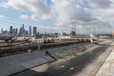
"Los Angeles County officials are proposing to take ownership of 40 miles of flood-control channels along the Los Angeles River from the federal government in order to expedite maintenance and water conservation improvements as climate change increases the frequency of extreme weather," reports Louis Sahagun.
The announcement brings into focus the conflicting missions of regional flood control regulators and the federal government. The mission of the Army Corps of Engineers, according to a source from the County Department of Public Works cited in the article, "does not include myriad issues his agency’s County Flood Control District regards as essential: water conservation, movement of sediment, graffiti removal, ecosystem friendly vegetation, homeless encampments and recreational opportunities."
The county hopes to take control of the river channel to speed up the delivery of groundwater storage projects, habitat restoration, new open and space and recreation projects, and new residential, commercial, and office development, according to the article.
The article also includes a lot more detail about the many pressing improvements required of dam and stormwater control infrastructure along the river—more reasons the county wants to take ownership of the river channel.
FULL STORY: County wants authority over L.A. River flood-control channels owned by U.S. government

A Comment for the L.A. River Master Plan
Five themes proposed to achieve justice and sustainability for the Los Angeles River and its surrounding communities.
$300 Million Property Tax to Fund Stormwater Infrastructure on the Ballot in Los Angeles County
The proposed property tax would double the county's stormwater capture capacity.
The Changing Paradigm of Stormwater Management
In the past, stormwater management has been about flood control. The future of stormwater, however, is in capturing, treating, and recharging water supply, according to this article.

Planetizen Federal Action Tracker
A weekly monitor of how Trump’s orders and actions are impacting planners and planning in America.

Map: Where Senate Republicans Want to Sell Your Public Lands
For public land advocates, the Senate Republicans’ proposal to sell millions of acres of public land in the West is “the biggest fight of their careers.”

Restaurant Patios Were a Pandemic Win — Why Were They so Hard to Keep?
Social distancing requirements and changes in travel patterns prompted cities to pilot new uses for street and sidewalk space. Then it got complicated.

Platform Pilsner: Vancouver Transit Agency Releases... a Beer?
TransLink will receive a portion of every sale of the four-pack.

Toronto Weighs Cheaper Transit, Parking Hikes for Major Events
Special event rates would take effect during large festivals, sports games and concerts to ‘discourage driving, manage congestion and free up space for transit.”

Berlin to Consider Car-Free Zone Larger Than Manhattan
The area bound by the 22-mile Ringbahn would still allow 12 uses of a private automobile per year per person, and several other exemptions.
Urban Design for Planners 1: Software Tools
This six-course series explores essential urban design concepts using open source software and equips planners with the tools they need to participate fully in the urban design process.
Planning for Universal Design
Learn the tools for implementing Universal Design in planning regulations.
Heyer Gruel & Associates PA
JM Goldson LLC
Custer County Colorado
City of Camden Redevelopment Agency
City of Astoria
Transportation Research & Education Center (TREC) at Portland State University
Camden Redevelopment Agency
City of Claremont
Municipality of Princeton (NJ)