


Florida set a goal in to eventually eliminate traffic fatalities on state roads and highways as part of its 2018 Highway Safety Plan. Neither a timeline nor the words vision zero were included.
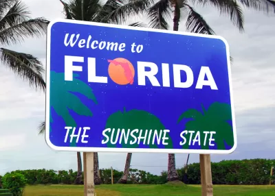
Digging into the most recent highway safety plan for the state of Florida reveals a perhaps surprising policy change.
"Florida (25.6% Latino) has become the first U.S. state to adopt a goal of zero traffic and pedestrian deaths each year," according to Amanda Merck.
That history-making policy direction is one of six safety performance measures included in the 2018 Highway Safety Plan [pdf], crafted to meet requirements set by the Federal Highway Administration's Highway Safety Improvement Program. The state stopped short of using the words "Vision Zero," but as Merck notes, the document is a big step forward from the 2017 safety plan, "where safety targets were not nearly as strict."
The 2018 Highway Safety Plan also notes that traffic fatalities have been rising in the state since 2015, despite "sharing" the national "Toward Zero Deaths" initiative and formally adopted a state version, titled "Driving Down Fatalities," in 2012 (page 3). The state and its cities have traditionally performed very poorly in traffic safety, most notably for pedestrians, so it will be interesting to monitor Florida's report on its 2018 safety plan, which the state must provide to the federal government later this year.
The bulk of Merck's post is devoted to explaining how planning and funding of state highway safety improvements work at the bureaucratic level. This safety plan explainer post is part of a three part series on transportation safety in the state of Florida. Earlier entries in the series covered complete streets and public transportation.
FULL STORY: Zero is Florida’s Big Traffic Fatality Goal

Federal Highway Administration Moving Toward Complete Streets
The Federal Highway Administration (FHWA) released a report to Congress this week that takes initial steps toward making complete streets the default model for funding and designing federally controlled roads.
FHWA Proposes Changes to Highway Safety Requirements
The proposed rule change would require states to include vulnerable road users in their road safety plans.
Experts: Vision Zero Requires Far-Reaching Investment, Culture Shift
Road safety advocates say the 2021 infrastructure bill doesn’t fully commit to its stated goals to help cities eliminate pedestrian and cyclist deaths.

Planetizen Federal Action Tracker
A weekly monitor of how Trump’s orders and actions are impacting planners and planning in America.

Map: Where Senate Republicans Want to Sell Your Public Lands
For public land advocates, the Senate Republicans’ proposal to sell millions of acres of public land in the West is “the biggest fight of their careers.”

Restaurant Patios Were a Pandemic Win — Why Were They so Hard to Keep?
Social distancing requirements and changes in travel patterns prompted cities to pilot new uses for street and sidewalk space. Then it got complicated.

Platform Pilsner: Vancouver Transit Agency Releases... a Beer?
TransLink will receive a portion of every sale of the four-pack.

Toronto Weighs Cheaper Transit, Parking Hikes for Major Events
Special event rates would take effect during large festivals, sports games and concerts to ‘discourage driving, manage congestion and free up space for transit.”

Berlin to Consider Car-Free Zone Larger Than Manhattan
The area bound by the 22-mile Ringbahn would still allow 12 uses of a private automobile per year per person, and several other exemptions.
Urban Design for Planners 1: Software Tools
This six-course series explores essential urban design concepts using open source software and equips planners with the tools they need to participate fully in the urban design process.
Planning for Universal Design
Learn the tools for implementing Universal Design in planning regulations.
Heyer Gruel & Associates PA
JM Goldson LLC
Custer County Colorado
City of Camden Redevelopment Agency
City of Astoria
Transportation Research & Education Center (TREC) at Portland State University
Camden Redevelopment Agency
City of Claremont
Municipality of Princeton (NJ)