


Smart Growth America has released its annual Dangerous by Design report, showing that many older, car-oriented cities are the country's most dangerous.
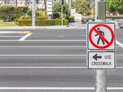
The Smart Growth America’s National Complete Streets Coalition released their annual report of the most dangerous cities in America for pedestrians. The Dangerous by Design report "…assigns each of the 104 largest cities in the country what’s called a Pedestrian Danger Index (PDI),' Alissa Walker writes for Curbed. "This is calculated by comparing the number of residents who walk to work and the rate of pedestrian fatalities." The top ten most dangerous cities are as follows:
- Cape Coral-Fort Myers, Florida
- Palm Bay-Melbourne-Titusville, Florida
- Orlando-Kissimmee-Sanford, Florida
- Jacksonville, Florida
- Deltona-Daytona Beach-Ormond Beach, Florida
- Lakeland-Winter Haven, Florida
- Tampa-St. Petersburg-Clearwater, Florida
- Jackson, Mississippi
- Memphis, Tennessee-Mississippi-Arkansas
- North Port-Sarasota-Bradenton, Florida
Sadly, trends in danger to pedestrians nationally are likely to move in the wrong direction. "Although the national figures are not out yet, 2016 saw a record high number of traffic fatalities on U.S. streets. And as our population ages dramatically, cities aren’t planning for seniors, who will be physically unable to drive," Walker reports.
FULL STORY: These are the most dangerous U.S. cities for pedestrians


Dangerous By Design: Streets Are Only Getting Less Safe for Pedestrians
The latest edition of the annual report by Smart Growth America and the National Complete Streets Coalition reports more and more death and tragedy on American streets and roads.

Houston Developers Question Mayor’s Stance on Pedestrian Projects
The new mayor’s reversal of road safety projects, some already underway or completed, is raising eyebrows among developers who say residents want walkable, mixed-use streets.
Historically Redlined Neighborhoods Have Higher Rates of Pedestrian Deaths, Study Says
The consequences of historic redlining continue to have consequences in the present day United States. Add another example to the list.

Maui's Vacation Rental Debate Turns Ugly
Verbal attacks, misinformation campaigns and fistfights plague a high-stakes debate to convert thousands of vacation rentals into long-term housing.

Planetizen Federal Action Tracker
A weekly monitor of how Trump’s orders and actions are impacting planners and planning in America.

In Urban Planning, AI Prompting Could be the New Design Thinking
Creativity has long been key to great urban design. What if we see AI as our new creative partner?

King County Supportive Housing Program Offers Hope for Unhoused Residents
The county is taking a ‘Housing First’ approach that prioritizes getting people into housing, then offering wraparound supportive services.

Researchers Use AI to Get Clearer Picture of US Housing
Analysts are using artificial intelligence to supercharge their research by allowing them to comb through data faster. Though these AI tools can be error prone, they save time and housing researchers are optimistic about the future.

Making Shared Micromobility More Inclusive
Cities and shared mobility system operators can do more to include people with disabilities in planning and operations, per a new report.
Urban Design for Planners 1: Software Tools
This six-course series explores essential urban design concepts using open source software and equips planners with the tools they need to participate fully in the urban design process.
Planning for Universal Design
Learn the tools for implementing Universal Design in planning regulations.
planning NEXT
Appalachian Highlands Housing Partners
Mpact (founded as Rail~Volution)
City of Camden Redevelopment Agency
City of Astoria
City of Portland
City of Laramie