


The latest edition of the annual report by Smart Growth America and the National Complete Streets Coalition reports more and more death and tragedy on American streets and roads.

"[T]he number of people struck and killed while walking has grown a startling 35 percent since 2008," according to Laura Bliss, who shares news of the most recent version of the "Dangerous By Design" report for CityLab.
The report cites numerous reasons for the increase in pedestrian fatalities, but singles out one factor in particular: "overly wide arterials that give too much space to cars and too little to humans."
"High-speed, multi-lane avenues that underpin sprawling urban growth, as opposed to slower, narrower streets that support walkable neighborhoods, are 'consistently linked ... to higher rates of both traffic-related deaths for people walking and traffic-related deaths overall,'" writes Bliss, quoting the report's words directly.
FULL STORY: American Roads Are Getting More Dangerous for Pedestrians


4 Proven Steps for Improved Pedestrian Safety
Experts from the National Association of City Transportation Officials (NACTO) present four steps for reducing the number of pedestrians killed by drivers.
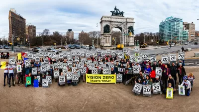
Zero Traffic Deaths Isn't as Far Fetched as It Sounds
Even supporters of Vision Zero—a goal to eliminate traffic fatalities from roadways adopted by cities and states all over the United States—doubt that such lofty ambitions are possible. But there are plenty of reasons to believe in the cause.
Atlanta Lowers Speed Limits Citywide
Vision Zero arrives in one of the country's most car-centric big cities.

Maui's Vacation Rental Debate Turns Ugly
Verbal attacks, misinformation campaigns and fistfights plague a high-stakes debate to convert thousands of vacation rentals into long-term housing.

Planetizen Federal Action Tracker
A weekly monitor of how Trump’s orders and actions are impacting planners and planning in America.

Chicago’s Ghost Rails
Just beneath the surface of the modern city lie the remnants of its expansive early 20th-century streetcar system.

Bend, Oregon Zoning Reforms Prioritize Small-Scale Housing
The city altered its zoning code to allow multi-family housing and eliminated parking mandates citywide.

Amtrak Cutting Jobs, Funding to High-Speed Rail
The agency plans to cut 10 percent of its workforce and has confirmed it will not fund new high-speed rail projects.

LA Denies Basic Services to Unhoused Residents
The city has repeatedly failed to respond to requests for trash pickup at encampment sites, and eliminated a program that provided mobile showers and toilets.
Urban Design for Planners 1: Software Tools
This six-course series explores essential urban design concepts using open source software and equips planners with the tools they need to participate fully in the urban design process.
Planning for Universal Design
Learn the tools for implementing Universal Design in planning regulations.
planning NEXT
Appalachian Highlands Housing Partners
Mpact (founded as Rail~Volution)
City of Camden Redevelopment Agency
City of Astoria
City of Portland
City of Laramie