


A new study concludes that not only is transit a safer way to travel, but communities oriented around transit are also safer. As a result, planning approaches that encourage transit also increase traffic safety.
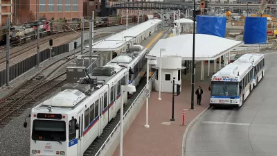
A new report [pdf] from the American Public Transportation Association looks at the relationship between public transit and traffic safety. The United States compared to peer countries ranks highest in terms of per capita vehicle mileage and traffic death rates. Among U.S. cities, the traffic fatality rate decreases as the number of per capita transit trips increases.
Angie Schmitt describes the report’s conclusion that factors related to public transit also increase traffic safety:
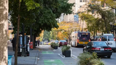
Transit is not only safer for the obvious reason — trains and buses are safer than cars — but because communities built around transit tend to have safer walking and biking amenities, fewer parking lots and safer street design. Such features, as well as higher population density, make it easier for people to make shorter car trips, or avoid them all together — reducing their overall exposure to crashes.
In addition, alternatives to driving, such as more available transit, promote less driving by high-risk groups, including youth, seniors, and alcohol drinkers, says APTA.
"APTA hopes the study will encourage increased transit funding. But the group also calls on cities and institutions to develop incentives — such as discounted fares — and disincentives, such as charging for parking by the day, to encourage drivers to switch to transit," reports Schmitt.
FULL STORY: The Best Tool for Reducing Traffic Deaths? More Transit!

How Complete Streets Stands to Lose in the FY26 ‘Skinny Budget’
The President’s proposed budget could cut key resources for active transportation, public transit, and road safety programs.
In Both Crashes and Crime, Public Transportation is Far Safer than Driving
Contrary to popular assumptions, public transportation has far lower crash and crime rates than automobile travel. For safer communities, improve and encourage transit travel.
North Texas Transportation Council Advocates for Road Safety, Rail Projects
The North Texas Regional Transportation Council issued a series of recommendations for state legislators that include more support for road safety projects and high-speed rail.

Planetizen Federal Action Tracker
A weekly monitor of how Trump’s orders and actions are impacting planners and planning in America.

Map: Where Senate Republicans Want to Sell Your Public Lands
For public land advocates, the Senate Republicans’ proposal to sell millions of acres of public land in the West is “the biggest fight of their careers.”

Restaurant Patios Were a Pandemic Win — Why Were They so Hard to Keep?
Social distancing requirements and changes in travel patterns prompted cities to pilot new uses for street and sidewalk space. Then it got complicated.

Platform Pilsner: Vancouver Transit Agency Releases... a Beer?
TransLink will receive a portion of every sale of the four-pack.

Toronto Weighs Cheaper Transit, Parking Hikes for Major Events
Special event rates would take effect during large festivals, sports games and concerts to ‘discourage driving, manage congestion and free up space for transit.”

Berlin to Consider Car-Free Zone Larger Than Manhattan
The area bound by the 22-mile Ringbahn would still allow 12 uses of a private automobile per year per person, and several other exemptions.
Urban Design for Planners 1: Software Tools
This six-course series explores essential urban design concepts using open source software and equips planners with the tools they need to participate fully in the urban design process.
Planning for Universal Design
Learn the tools for implementing Universal Design in planning regulations.
Heyer Gruel & Associates PA
JM Goldson LLC
Custer County Colorado
City of Camden Redevelopment Agency
City of Astoria
Transportation Research & Education Center (TREC) at Portland State University
Camden Redevelopment Agency
City of Claremont
Municipality of Princeton (NJ)