


Vancouver combined environmental goals and traffic safety goals.

David Goldberg shares the story of Vancouver's approach to street trees, and their benefit to traffic safety.
In the late 20th century, the city began to use traffic circles and curb bulges — or bulbs, as they’re known stateside — to slow traffic in residential areas, and quickly learned that the new spaces provided an opportunity for gardening. Vancouver’s popular Green Streets program recruits volunteers to tend gardens in the traffic calming spaces, with the city paying for the initial planting. In the 1990s, the city began converting side streets into “bike boulevards” and pursued a “greenways” plan that tore out asphalt and concrete in some places to make park-like streets where biking and walking were comfortable. Today, the city has 108 miles of such corridors.
According to Golberg, Vancouver's connection between trees and safety is a unique take on the "complete streets" concept of street design. Vancouver implements its street trees programs in accordance with the Renewable City action plan from 2015 and the Greenest City action plan from 2015. The city is also currently working on an integrated stormwater management plan.
FULL STORY: Thanks to Comprehensive Street Design, Vancouver Sows for the Future


Maryland Plans Quick-Build Complete Streets Projects
The state will use low-cost interventions to improve road safety in five Maryland counties.
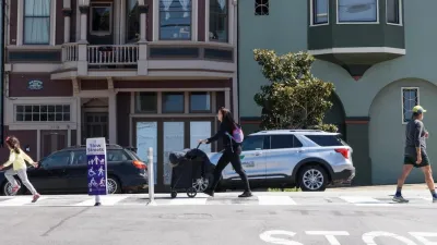
San Francisco Slow Streets Bucks Citywide Trend, Reducing Injuries by 61 Percent
Low-cost interventions aimed at slowing traffic are making a major impact on road safety.
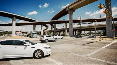
Report: Vision Zero Saving Lives in Austin
Safety improvements at major intersections led to a 22 percent reduction in deaths and severe injuries and saved the city over $28 million.

Planetizen Federal Action Tracker
A weekly monitor of how Trump’s orders and actions are impacting planners and planning in America.

Map: Where Senate Republicans Want to Sell Your Public Lands
For public land advocates, the Senate Republicans’ proposal to sell millions of acres of public land in the West is “the biggest fight of their careers.”

Restaurant Patios Were a Pandemic Win — Why Were They so Hard to Keep?
Social distancing requirements and changes in travel patterns prompted cities to pilot new uses for street and sidewalk space. Then it got complicated.

Platform Pilsner: Vancouver Transit Agency Releases... a Beer?
TransLink will receive a portion of every sale of the four-pack.

Toronto Weighs Cheaper Transit, Parking Hikes for Major Events
Special event rates would take effect during large festivals, sports games and concerts to ‘discourage driving, manage congestion and free up space for transit.”

Berlin to Consider Car-Free Zone Larger Than Manhattan
The area bound by the 22-mile Ringbahn would still allow 12 uses of a private automobile per year per person, and several other exemptions.
Urban Design for Planners 1: Software Tools
This six-course series explores essential urban design concepts using open source software and equips planners with the tools they need to participate fully in the urban design process.
Planning for Universal Design
Learn the tools for implementing Universal Design in planning regulations.
Heyer Gruel & Associates PA
JM Goldson LLC
Custer County Colorado
City of Camden Redevelopment Agency
City of Astoria
Transportation Research & Education Center (TREC) at Portland State University
Camden Redevelopment Agency
City of Claremont
Municipality of Princeton (NJ)