


Large-scale road and rail projects aim to facilitate travel from the south of Italy all the way up to Sweden and Finland.

Central Europe has a number of borders and natural choke points that can make traveling difficult. "With their tightly interlinked shipping lanes and industrial supply chains, Copenhagen and Hamburg are already one economy in many senses. But getting between them is a hassle," according to an article in The Economist. Another hassle waits in crossing the Austrian and Swiss Alps, but projects including a Brenner Tunnel are bringing trains under the Alps to make this travel easier than it's ever been before.
The split between Eastern and Western Europe might be famous, but from a geographic perspective the split between northern and southern Europe is more pronounced, The Economist argues. "It is soluble. But the continent’s north-south rift is in many ways deeper: it involves intransigent barriers like high mountains and foaming seas, as well as deep cultural and economic differences. In its own way, the Malmo-Palermo express would be as great a political achievement as its Paris-Moscow counterpart," The Economist contends.
FULL STORY: Two giant engineering projects will alter the European landscape


The World's Highest Rates of Coronavirus Infections and Deaths
Brazil and the U.S. lead the world in daily COVID-19 cases and deaths. Western Europe is undergoing a third wave of infections, resulting in a new round of lockdowns, yet most of these nations are not among the 12 hotspots shown on a global tracker.
The Great Scandinavian Pandemic Experiment
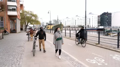
Perhaps no nation has captured more media attention in its handling of the coronavirus pandemic than Sweden. Unlike most of Europe, it never went into lockdown, relying mostly on voluntary social distancing. The state epidemiologist devised the plan.
Solving Sweden's Trash Deficit
You read that right, Sweden's trash problem is that it doesn't have enough of it. Due to a spectacularly successful rate of recycling, the country doesn't have enough garbage to power its waste-to-energy program. It's solution: import trash.

Planetizen Federal Action Tracker
A weekly monitor of how Trump’s orders and actions are impacting planners and planning in America.

Map: Where Senate Republicans Want to Sell Your Public Lands
For public land advocates, the Senate Republicans’ proposal to sell millions of acres of public land in the West is “the biggest fight of their careers.”

Restaurant Patios Were a Pandemic Win — Why Were They so Hard to Keep?
Social distancing requirements and changes in travel patterns prompted cities to pilot new uses for street and sidewalk space. Then it got complicated.

Platform Pilsner: Vancouver Transit Agency Releases... a Beer?
TransLink will receive a portion of every sale of the four-pack.

Toronto Weighs Cheaper Transit, Parking Hikes for Major Events
Special event rates would take effect during large festivals, sports games and concerts to ‘discourage driving, manage congestion and free up space for transit.”

Berlin to Consider Car-Free Zone Larger Than Manhattan
The area bound by the 22-mile Ringbahn would still allow 12 uses of a private automobile per year per person, and several other exemptions.
Urban Design for Planners 1: Software Tools
This six-course series explores essential urban design concepts using open source software and equips planners with the tools they need to participate fully in the urban design process.
Planning for Universal Design
Learn the tools for implementing Universal Design in planning regulations.
Heyer Gruel & Associates PA
JM Goldson LLC
Custer County Colorado
City of Camden Redevelopment Agency
City of Astoria
Transportation Research & Education Center (TREC) at Portland State University
Camden Redevelopment Agency
City of Claremont
Municipality of Princeton (NJ)