


All it takes a map, a bike, and a desire to learn the history of racial segregation in the United States.
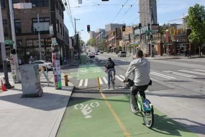
Ann Dornfield reports on a new bike tour of the redlining that enabled the segregation the city of Seattle even after it passed an open housing ordinance in 1968.
The bike tour is the creation of Merlin Rainwater, who was inspired to bring the history of redlining to the mostly white audience that typically attends her guided bike tours after encountering several of the publicly available resources about redlining practices of the 20th century.
"…I thought, you know, this is information that really ought to be in Laurelhurst. It should be in Broadmoor," Rainwater said. "Because black people in the Central District, they know this history. It's the white folks in the segregated white parts of the city that need to know that there was a struggle for open housing in Seattle."
So far the bike tour has been very popular, according to the article. "Rainwater hopes people come away from the tour with the understanding that racial segregation was no accident," adds Dornfield.
FULL STORY: This bike tour shows Seattle’s racial segregation is no accident


Rethinking Redlining
For decades we have blamed 100-year-old maps for the patterns of spatial racial inequity that persist in American cities today. An esteemed researcher says: we’ve got it all wrong.
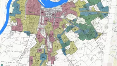
Story Mapping the Racism in Planning History
A Story Map created by the Louisville Metro Office of Planning & Design Services offers a detailed, visual presentation of the history of racism and discriminatory in the planning and zoning of the Louisville and Jefferson County.

Formerly Redlined Neighborhoods Have Higher COVID-19 Prevalence, Study Says
Add COVID-19 to the list of long-term consequences of the racist and discriminatory regulatory and lending practices of the 20th century.

Planetizen Federal Action Tracker
A weekly monitor of how Trump’s orders and actions are impacting planners and planning in America.

Restaurant Patios Were a Pandemic Win — Why Were They so Hard to Keep?
Social distancing requirements and changes in travel patterns prompted cities to pilot new uses for street and sidewalk space. Then it got complicated.

Map: Where Senate Republicans Want to Sell Your Public Lands
For public land advocates, the Senate Republicans’ proposal to sell millions of acres of public land in the West is “the biggest fight of their careers.”

Maui's Vacation Rental Debate Turns Ugly
Verbal attacks, misinformation campaigns and fistfights plague a high-stakes debate to convert thousands of vacation rentals into long-term housing.

San Francisco Suspends Traffic Calming Amidst Record Deaths
Citing “a challenging fiscal landscape,” the city will cease the program on the heels of 42 traffic deaths, including 24 pedestrians.

California Homeless Arrests, Citations Spike After Ruling
An investigation reveals that anti-homeless actions increased up to 500% after Grants Pass v. Johnson — even in cities claiming no policy change.
Urban Design for Planners 1: Software Tools
This six-course series explores essential urban design concepts using open source software and equips planners with the tools they need to participate fully in the urban design process.
Planning for Universal Design
Learn the tools for implementing Universal Design in planning regulations.
Heyer Gruel & Associates PA
JM Goldson LLC
Custer County Colorado
City of Camden Redevelopment Agency
City of Astoria
Transportation Research & Education Center (TREC) at Portland State University
Camden Redevelopment Agency
City of Claremont
Municipality of Princeton (NJ)