


A proposal once too controversial to consider is gaining traction at several layers of government.
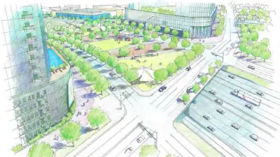
A plan to bury a 1.4-mile stretch of Interstate 345 that bisects Downtown Dallas is back on the table in City Hall, according to an article by Robert Wilonsky.
Wilonsky notes that it's been awhile since the controversial proposal, detailed in a study published by the Texas Department of Transportation (TxDOT) in July 2016, was a talking point at the city level. But earlier this week, "a council committee tentatively approved looking at the land beneath the 43-year-old overpass — how much it's really worth, what you can really build there if the overpass is erased."
Wilonsky also describes the project that could potentially erase I-345 from the city. The proposal would "[sink] the freeway below grade and [deck] it, maybe with a park but more than likely with mixed-use and commercial developments that would restitch the city center with Deep Ellum and East Dallas.
Wilonsky offers some opinions about the current state of I-345—let's just say he's ready for a change.
Both the city and the state have come a long way on the issue of what to do about the highway, as documented by reporters like Wilonsky and Dallas Morning News Architecture Critic Mark Lamster. Planetizen has also been tracking their work on this proposal over the years.
FULL STORY: Dallas might be ready to bury a downtown highway — and it's about time

A New Ally in the Fight Against Car-Centric Planning in Dallas: TxDOT
The Texas Department of Transportation (TxDOT) has envisioned a future for Downtown Dallas that includes more downtown and fewer freeways.
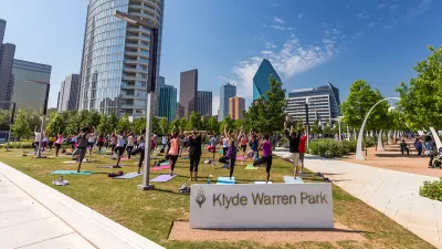
Proposal Would Add Another Deck to Dallas' Klyde Warren Park
The Dallas News reviews a proposal that would extend the reach of one of the most successful public spaces in Dallas.
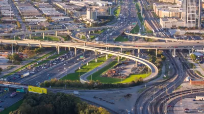
TxDOT Recommends a 10-Lane ‘Infrastructure Grave’ in Dallas
Rather than removing the freeway altogether, which the Texas Department of Transportation calls ‘unfeasible,’ the agency recommends burying the road in a billion-dollar, ten-lane trench through the city’s downtown.

Planetizen Federal Action Tracker
A weekly monitor of how Trump’s orders and actions are impacting planners and planning in America.

San Francisco's School District Spent $105M To Build Affordable Housing for Teachers — And That's Just the Beginning
SFUSD joins a growing list of school districts using their land holdings to address housing affordability challenges faced by their own employees.

The Tiny, Adorable $7,000 Car Turning Japan Onto EVs
The single seat Mibot charges from a regular plug as quickly as an iPad, and is about half the price of an average EV.

Seattle's Plan for Adopting Driverless Cars
Equity, safety, accessibility and affordability are front of mind as the city prepares for robotaxis and other autonomous vehicles.

As Trump Phases Out FEMA, Is It Time to Flee the Floodplains?
With less federal funding available for disaster relief efforts, the need to relocate at-risk communities is more urgent than ever.

With Protected Lanes, 460% More People Commute by Bike
For those needing more ammo, more data proving what we already knew is here.
Urban Design for Planners 1: Software Tools
This six-course series explores essential urban design concepts using open source software and equips planners with the tools they need to participate fully in the urban design process.
Planning for Universal Design
Learn the tools for implementing Universal Design in planning regulations.
Smith Gee Studio
City of Charlotte
City of Camden Redevelopment Agency
City of Astoria
Transportation Research & Education Center (TREC) at Portland State University
US High Speed Rail Association
City of Camden Redevelopment Agency
Municipality of Princeton (NJ)