


This story begins and ends with a freeway.
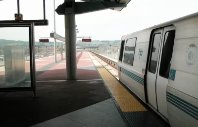
Alon Levy critiques the plan for a new BART extension proposed for the city of Livermore, located on the suburban fringe of the East Bay Area. According to Levy's argument, the new extension continues BART's focus on suburban service, which limits ridership relative to the other U.S. rail transit system of comparative scope (i.e., the Metrorail system of the Washington, D.C. region).
In 2006, transit expert Christof Spieler, now serving on the board of Houston METRO, compared the two systems, writing that BART mostly serves the suburbs, whereas the Washington Metro serves both the suburbs and the urban core. Unfortunately, BART's plans for expansion keep prioritizing suburban service. The best example of this is the extension to Livermore, for which BART released the environmental reviews on Monday.
According to Levy's critique, the Livermore BART extension's fatal mistake is in its route down the I-580 Freeway. According to Levy, "[f]reeway running is not common on the highest-performance urban rail systems, because nobody wants to live, work, or play right next to a freeway. People prefer living a few minutes by car from the freeway for easy access." It's freeway alignment means this BART extension is already doomed to low ridership, especially in off-peak hours.
But low expected ridership is not the only flaw Levy finds with the Livermore BART extension, there's also high costs—per rider, the cost is expected to be four times as expensive as the recently completed Second Avenue Subway in New York City.
FULL STORY: Livermore BART is the Most Expensive Disaster Ever

BART Extension Kerfluffle: East Bay Officials Pushing for New Rail Authority
If the city of Livermore and several state legislators gets their way, a proposed extension of BART to the city of Livermore would be planned and built by the Tri Valley-San Joaquin Valley Regional Rail Authority.

BART’s Phase II Extension Into San Jose Ready to Go
A long-awaited extension of the Bay Area’s regional rail transit system is finally coming into view, with an expected completion date of 2030.
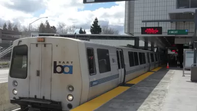
BART Board of Directors Votes Down Livermore Extension
A controversial vote sets a "fix it first" agenda for regional transit planning—the implications of this decision could potentially reach far beyond the scope of this single project.

Planetizen Federal Action Tracker
A weekly monitor of how Trump’s orders and actions are impacting planners and planning in America.

Chicago’s Ghost Rails
Just beneath the surface of the modern city lie the remnants of its expansive early 20th-century streetcar system.

San Antonio and Austin are Fusing Into one Massive Megaregion
The region spanning the two central Texas cities is growing fast, posing challenges for local infrastructure and water supplies.

Since Zion's Shuttles Went Electric “The Smog is Gone”
Visitors to Zion National Park can enjoy the canyon via the nation’s first fully electric park shuttle system.

Trump Distributing DOT Safety Funds at 1/10 Rate of Biden
Funds for Safe Streets and other transportation safety and equity programs are being held up by administrative reviews and conflicts with the Trump administration’s priorities.

German Cities Subsidize Taxis for Women Amid Wave of Violence
Free or low-cost taxi rides can help women navigate cities more safely, but critics say the programs don't address the root causes of violence against women.
Urban Design for Planners 1: Software Tools
This six-course series explores essential urban design concepts using open source software and equips planners with the tools they need to participate fully in the urban design process.
Planning for Universal Design
Learn the tools for implementing Universal Design in planning regulations.
planning NEXT
Appalachian Highlands Housing Partners
Mpact (founded as Rail~Volution)
City of Camden Redevelopment Agency
City of Astoria
City of Portland
City of Laramie