


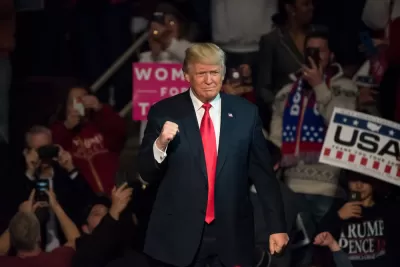
The original purpose of President Trump's press conference were lost as the discussion devolved.
Hallie Busta reports on the executive order signed by president Donald Trump on August 15, 2016, "concerning the environmental review and permitting process for infrastructure projects."
"The order nixes the Obama-era Federal Flood Risk Management Standard, which set higher resiliency standards for projects that receive federal funds and are vulnerable to sea-level rise," according to Busta. Valerie Volcovici and Jeff Mason report in a separate article on those features of the executive order.
Busta also notes that President Trump "unfurled a flowchart that he said detailed the new approvals process for federal highway projects," during the press conference.
Although the flow chart was largely unreadable during the press conference, an article by Annalisa Merelli later followed up with an article that presents the flow chart in digital form. "The president had showed this chart in April, and he did so again today (Aug. 15), together with a shorter version without the many steps he plans to cut," reports Merelli.
The infrastructure revelations of a press conference soon became mired in controversy over the president's reactions to the violence in tragedy in Charlottesville, Virginia the previous weekend, but according to Busta's take on the executive order and the flow chart, there is still very little detail about the $1 trillion investment President Trump has repeatedly promised for the nation's infrastructure.
FULL STORY: Trump signs executive order to streamline infrastructure approvals

Trump's Infrastructure Accomplishments Fall Short of Promises
President Trump has fallen short of 2016 promises to update and upgrade the key infrastructure of the United States, according to this article.

Pelosi-Schumer-Trump Infrastructure Plan Already Meeting Resistance
Introduced on April 30, the $2 trillion conceptual plan is likely to be dismissed by Congressional Republicans wary of increasing taxes and adding to the deficit, according to an extensive article by The Hill published three days later.
Trump's 25-Cent Infrastructure Tax?
During a closed-door meeting Wednesday with Democratic and Republican lawmakers, President Trump endorsed hiking the gas tax by 25-cents per gallon to help pay for the $200 billion investment and restore solvency to the Highway Trust Fund.

Planetizen Federal Action Tracker
A weekly monitor of how Trump’s orders and actions are impacting planners and planning in America.

Congressman Proposes Bill to Rename DC Metro “Trump Train”
The Make Autorail Great Again Act would withhold federal funding to the system until the Washington Metropolitan Area Transit Authority (WMATA), rebrands as the Washington Metropolitan Authority for Greater Access (WMAGA).

The Simple Legislative Tool Transforming Vacant Downtowns
In California, Michigan and Georgia, an easy win is bringing dollars — and delight — back to city centers.

The States Losing Rural Delivery Rooms at an Alarming Pace
In some states, as few as 9% of rural hospitals still deliver babies. As a result, rising pre-term births, no adequate pre-term care and "harrowing" close calls are a growing reality.

The Small South Asian Republic Going all in on EVs
Thanks to one simple policy change less than five years ago, 65% of new cars in this Himalayan country are now electric.

DC Backpedals on Bike Lane Protection, Swaps Barriers for Paint
Citing aesthetic concerns, the city is removing the concrete barriers and flexposts that once separated Arizona Avenue cyclists from motor vehicles.
Urban Design for Planners 1: Software Tools
This six-course series explores essential urban design concepts using open source software and equips planners with the tools they need to participate fully in the urban design process.
Planning for Universal Design
Learn the tools for implementing Universal Design in planning regulations.
Smith Gee Studio
City of Charlotte
City of Camden Redevelopment Agency
City of Astoria
Transportation Research & Education Center (TREC) at Portland State University
US High Speed Rail Association
City of Camden Redevelopment Agency
Municipality of Princeton (NJ)