


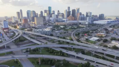
The infrastructure improvements funded by the ReBuild Houston initiative are moving forward. The latest example, the Lower Westheimer Corridor Study, recently released a concept video to make the case for a suite of roadway improvements.
"This week the city of Houston released a video of a virtual drive down what the Lower Westheimer area would look like after planned changes are made," according to an article by Craig Hlavaty.
The Lower Westheimer Corridor Study is funded by ReBuild Houston, the city's controversial drainage fee designed to fund infrastructure repair projects. According to the city's Corridor Study website, a nine-month study will help the city produce recommendations for an improved roadway design "that considers the needs of all of the stakeholders" while preserving and enhancing the character of the corridor and improving mobility and safety.
In the meantime, stakeholders and residents (and the rest of us around the country) can check out the concept visualization.
FULL STORY: City of Houston video lets locals virtually drive down Lower Westheimer after proposed changes

TxDOT Approves I-45 Widening Despite Local Opposition
Despite every manner of local opposition, the Texas Department of Transportation is pushing forward with a plan to widen Interstate 45 north of the city of Houston, demolishing and displacing thousands of homes, businesses, and community facilities.
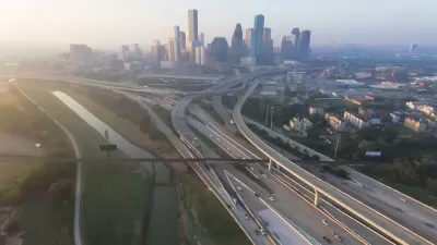
Environmental Study Released for $7 Billion Houston Highway Project
The final environmental impact statement for the controversial North Houston Highway Improvement Project is available for public comment, courtesy of the Texas Department of Transportation.
Tolls Not Included: Toll Proposals Keep Ending Up in the Dustbin in Texas
Another example of the growing political and planning opposition to the idea of tolling new roads in Texas.

Planetizen Federal Action Tracker
A weekly monitor of how Trump’s orders and actions are impacting planners and planning in America.

Map: Where Senate Republicans Want to Sell Your Public Lands
For public land advocates, the Senate Republicans’ proposal to sell millions of acres of public land in the West is “the biggest fight of their careers.”

Restaurant Patios Were a Pandemic Win — Why Were They so Hard to Keep?
Social distancing requirements and changes in travel patterns prompted cities to pilot new uses for street and sidewalk space. Then it got complicated.

Platform Pilsner: Vancouver Transit Agency Releases... a Beer?
TransLink will receive a portion of every sale of the four-pack.

Toronto Weighs Cheaper Transit, Parking Hikes for Major Events
Special event rates would take effect during large festivals, sports games and concerts to ‘discourage driving, manage congestion and free up space for transit.”

Berlin to Consider Car-Free Zone Larger Than Manhattan
The area bound by the 22-mile Ringbahn would still allow 12 uses of a private automobile per year per person, and several other exemptions.
Urban Design for Planners 1: Software Tools
This six-course series explores essential urban design concepts using open source software and equips planners with the tools they need to participate fully in the urban design process.
Planning for Universal Design
Learn the tools for implementing Universal Design in planning regulations.
Heyer Gruel & Associates PA
JM Goldson LLC
Custer County Colorado
City of Camden Redevelopment Agency
City of Astoria
Transportation Research & Education Center (TREC) at Portland State University
Camden Redevelopment Agency
City of Claremont
Municipality of Princeton (NJ)