


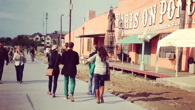
The Lawrence Avenue corridor in Chicago is poised to evolve into "New Lawrence," but as development proposals follow a streetscape improvement project, the community is still sorting out what exactly "new" should mean.
Patty Wetli reports in the wake of the Lawrence Avenue streetscape improvement in Chicago, where pedestrian and bike friendly investments where designed to attract developers along the corridor. In fact, "[n]ow that all major work on the streetscape has been completed, including a controversial 'road diet' that removed a lane of traffic, signs indicate the project is beginning to deliver on that promise," explains Wetli.
The article dives into the details of a few of the development proposals for new density along the corridor. In the process, a telling point about the catalytic limitations of the streetscape improvements is made: despite the street reconfiguration, foot traffic is still lagging in the neighborhood. What's needed to achieve something special in the neighborhood, according to one developer quoted in the article, is "to build up the busy streets."
The development plans have provoked opposition from some locals, one local in particular, Bob Farster, is hoping to create a neighborhood association to help keep the focus on what can be done, rather than just insisting on what should not be done. "The trick," writes Wetli, "will be to find the middle ground between developers who would like to see all of Lawrence redeveloped in one swoop and residents who would like to reject everything."
FULL STORY: Development Is Coming to Lawrence Avenue, Is the Neighborhood Ready?

The Atlanta Beltline—20 Years Later
The scope of the Atlanta Beltline's effect on the city has astounded most observers, including the person who came up with the idea first.
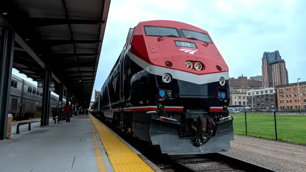
Amtrak’s Borealis Exceeds First Year Ridership Expectations
205,800 passengers have boarded the St. Paul to Chicago line, well above initial MDOT projections.

Chicago Judge Orders Thousands of Accessible Ped Signals
Only 3% of the city's crossing signals are currently accessible to blind pedestrians.

Planetizen Federal Action Tracker
A weekly monitor of how Trump’s orders and actions are impacting planners and planning in America.

Map: Where Senate Republicans Want to Sell Your Public Lands
For public land advocates, the Senate Republicans’ proposal to sell millions of acres of public land in the West is “the biggest fight of their careers.”

Restaurant Patios Were a Pandemic Win — Why Were They so Hard to Keep?
Social distancing requirements and changes in travel patterns prompted cities to pilot new uses for street and sidewalk space. Then it got complicated.

Platform Pilsner: Vancouver Transit Agency Releases... a Beer?
TransLink will receive a portion of every sale of the four-pack.

Toronto Weighs Cheaper Transit, Parking Hikes for Major Events
Special event rates would take effect during large festivals, sports games and concerts to ‘discourage driving, manage congestion and free up space for transit.”

Berlin to Consider Car-Free Zone Larger Than Manhattan
The area bound by the 22-mile Ringbahn would still allow 12 uses of a private automobile per year per person, and several other exemptions.
Urban Design for Planners 1: Software Tools
This six-course series explores essential urban design concepts using open source software and equips planners with the tools they need to participate fully in the urban design process.
Planning for Universal Design
Learn the tools for implementing Universal Design in planning regulations.
Heyer Gruel & Associates PA
JM Goldson LLC
Custer County Colorado
City of Camden Redevelopment Agency
City of Astoria
Transportation Research & Education Center (TREC) at Portland State University
Camden Redevelopment Agency
City of Claremont
Municipality of Princeton (NJ)