


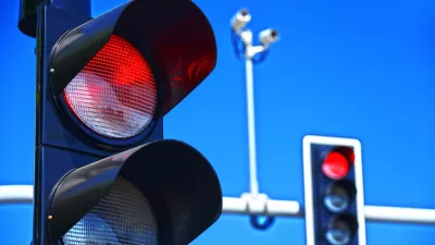
Some cities take their surveillance of traffic violations very seriously. Washington, D.C., this time we're looking at you.
Sarak Kliff and Soo Oh report on the work of Jonathan Melby and Angela Buffington, who since 2006 have gathered and maintained a massive database of all of the red light cameras and speed cameras in North America. "This database now has 3,699 red light cameras and 1,413 speed cameras — although that could change as the list is updated each week," according to Kliff and Oh.
Kliff and Oh used the database to produce an interactive map of each of those cameras, which allows users to compare each city's traffic cameras. The article accompanying the map also includes thoughts and insights Melby and Buffington about the process of maintaining the database. For instance, the database reveals Washington, D.C. to have the most traffic cameras in the country. Melby and Buffington also report some of the characteristics of camera systems in cities like New York and Phoenix.
FULL STORY: America’s 4,150 traffic cameras, in one map

Legislation to Ban Traffic Cameras Creates Odd Political Alliances
Republicans and the American Civil Liberties Union back bills to ban red light and speed cameras in Iowa, while Democrats and law enforcement want to allow cities and counties to retain automated traffic-enforcement tools.

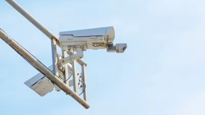
DC’s Traffic Cameras Are Working, but Not a Panacea
Automated enforcement is reducing speeding, but bigger changes to street design and the built environment are needed to make the District’s streets safer and more pleasant for people walking.
Iowa Outlaws Most Automated Speed Cameras
The Iowa Department of Transportation has rejected a majority of applications to continue speed camera programs in cities across the state based on a new state law that requires state-issued permits for automated traffic enforcement.

Planetizen Federal Action Tracker
A weekly monitor of how Trump’s orders and actions are impacting planners and planning in America.

San Francisco's School District Spent $105M To Build Affordable Housing for Teachers — And That's Just the Beginning
SFUSD joins a growing list of school districts using their land holdings to address housing affordability challenges faced by their own employees.

Can We Please Give Communities the Design They Deserve?
Often an afterthought, graphic design impacts everything from how we navigate a city to how we feel about it. One designer argues: the people deserve better.

The EV “Charging Divide” Plaguing Rural America
With “the deck stacked” against rural areas, will the great electric American road trip ever be a reality?

Judge Halts Brooklyn Bike Lane Removal
Lawyers must prove the city was not acting “arbitrarily, capriciously, and illegally” in ordering the hasty removal.

Engineers Gave America's Roads an Almost Failing Grade — Why Aren't We Fixing Them?
With over a trillion dollars spent on roads that are still falling apart, advocates propose a new “fix it first” framework.
Urban Design for Planners 1: Software Tools
This six-course series explores essential urban design concepts using open source software and equips planners with the tools they need to participate fully in the urban design process.
Planning for Universal Design
Learn the tools for implementing Universal Design in planning regulations.
Borough of Carlisle
Smith Gee Studio
City of Camden Redevelopment Agency
City of Astoria
Transportation Research & Education Center (TREC) at Portland State University
City of Camden Redevelopment Agency
Municipality of Princeton (NJ)