


Existing grey infrastructure in China cannot cope with rapid urban expansion and frequent droughts and floods. Several cities, with Beijing's approval, are experimenting with rainwater capture methods as an alternative.
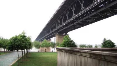
Chinese planners and engineers are hard pressed to keep up with demands for working infrastructure. "Experts say that climate change has played a role in the increase of urban flooding, producing more rainfall during shorter periods. Besides that, rapid urbanization has outpaced stormwater removal."
The widespread adoption of rainwater capture techniques may alleviate drought as well as flooding. Enter the so-called 'sponge city.' "The new design aims to build up infrastructure to collect excess rainfall and integrate flood control in urban planning [...] When rain falls lightly, the water either filters down to the underground through permeable pavements or is soaked up by gardens designed to catch rain. Almost no rainwater flows into street gutters [...]"
President Xi Jinping has been quick to back the idea. "Earlier this year, the Chinese central government pledged to provide billions of dollars in financial assistance over the next three years, in an effort to help 16 cities morph into urban sponges."
Although installing rainwater capture infrastructure can be disruptive on the ground, residents reportedly approved of some initial measures when they successfully prevented flooding in their neighborhoods.
FULL STORY: China bets on 'sponge cities' to cope with flooding and drought


Wastewater System Upgrade Plans Already Out of Date
Some Midwest cities' plans to upgrade decades-old sewer systems rely on outdated rainfall predictions as flood risks grow due to climate change and shifting weather patterns.

Study: Outdated Stormwater Infrastructure Exacerbates Flooding
Infrastructure built to mitigate flooding a century ago no longer serves current needs.
Federal Dollars Could Pave the Way for Greener, More Equitable Infrastructure
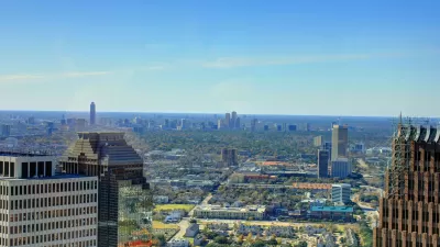
Houston's director of Transportation and Drainage Operations wants to see more sustainable development in the city that has historically depended on freeways as its critical infrastructure.

Planetizen Federal Action Tracker
A weekly monitor of how Trump’s orders and actions are impacting planners and planning in America.

Congressman Proposes Bill to Rename DC Metro “Trump Train”
The Make Autorail Great Again Act would withhold federal funding to the system until the Washington Metropolitan Area Transit Authority (WMATA), rebrands as the Washington Metropolitan Authority for Greater Access (WMAGA).

DARTSpace Platform Streamlines Dallas TOD Application Process
The Dallas transit agency hopes a shorter permitting timeline will boost transit-oriented development around rail stations.

Affordable Housing Finance 101
The financial intricacies involved in building affordable housing can be difficult to understand. This explainer breaks down the foundational concepts.

San Francisco's School District Spent $105M To Build Affordable Housing for Teachers — And That's Just the Beginning
SFUSD joins a growing list of school districts using their land holdings to address housing affordability challenges faced by their own employees.

Car-Centric LA Suburb Looks to a Train-Oriented Future
City leaders in Rancho Cucamonga, the future western terminus of the Brightline West rail line to Las Vegas, want to reimagine the city as a transit-oriented, pedestrian-friendly community.
Urban Design for Planners 1: Software Tools
This six-course series explores essential urban design concepts using open source software and equips planners with the tools they need to participate fully in the urban design process.
Planning for Universal Design
Learn the tools for implementing Universal Design in planning regulations.
Municipality of Princeton
Roanoke Valley-Alleghany Regional Commission
City of Mt Shasta
City of Camden Redevelopment Agency
City of Astoria
Transportation Research & Education Center (TREC) at Portland State University
US High Speed Rail Association
City of Camden Redevelopment Agency
Municipality of Princeton (NJ)