


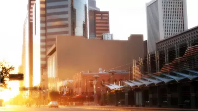
Until last week, the seasons never changed on satellite image software. But Mapbox's Landsat-Live program shares clear images of the Earth's surface in near-real time.
"Launched Thursday, a landmark project from Mapbox has changed the summertime paradigm for online cartography," reports Laura Bliss. "Landsat-live reveals the planet's surface in real time and in stunning resolution, fed by a constant stream of public-domain imagery from NASA’s Landsat 8 satellite."
Bliss goes on to detail the features of the new addition to the cartography toolbox, including giving credit to the U.S. Geological Survey and Amazon Web Services for making the images free and available to the public.
The result is satellite imagery that is 16 days old at the most, according to Bliss, which enables all kinds of practical applications, such as environmental and agricultural monitoring. The article also includes an embedded version and screengrabs from the Landsat-live app.
FULL STORY: Roam the World in (Almost) Real Time

Can an Upstart Mapmaker Beat Google and Microsoft at Their Own Game?
Glenn Fleishman profiles MapBox, whose 30 employees are taking on the big boys in the development of interactive street and satellite maps. The company is working with Charlie Loyd to develop "the most beautiful, clean map ever made."
Satellite, Launched Into Space Earlier This Month, to Measure Urban Heat Island Effect
A new satellite, currently residing on the International Space Station and scheduled for deployment in January, will measure and map the urban heat island effect of seven U.S. cities.

View the Smoke from the California Fires From Satellite
The National Oceanic and Atmospheric Administration has been making the most of its celestial perch to illustrate the scale of the fires currently burning in Southern California.

Planetizen Federal Action Tracker
A weekly monitor of how Trump’s orders and actions are impacting planners and planning in America.

Map: Where Senate Republicans Want to Sell Your Public Lands
For public land advocates, the Senate Republicans’ proposal to sell millions of acres of public land in the West is “the biggest fight of their careers.”

Restaurant Patios Were a Pandemic Win — Why Were They so Hard to Keep?
Social distancing requirements and changes in travel patterns prompted cities to pilot new uses for street and sidewalk space. Then it got complicated.

Platform Pilsner: Vancouver Transit Agency Releases... a Beer?
TransLink will receive a portion of every sale of the four-pack.

Toronto Weighs Cheaper Transit, Parking Hikes for Major Events
Special event rates would take effect during large festivals, sports games and concerts to ‘discourage driving, manage congestion and free up space for transit.”

Berlin to Consider Car-Free Zone Larger Than Manhattan
The area bound by the 22-mile Ringbahn would still allow 12 uses of a private automobile per year per person, and several other exemptions.
Urban Design for Planners 1: Software Tools
This six-course series explores essential urban design concepts using open source software and equips planners with the tools they need to participate fully in the urban design process.
Planning for Universal Design
Learn the tools for implementing Universal Design in planning regulations.
Heyer Gruel & Associates PA
JM Goldson LLC
Custer County Colorado
City of Camden Redevelopment Agency
City of Astoria
Transportation Research & Education Center (TREC) at Portland State University
Camden Redevelopment Agency
City of Claremont
Municipality of Princeton (NJ)