


Glenn Fleishman profiles MapBox, whose 30 employees are taking on the big boys in the development of interactive street and satellite maps. The company is working with Charlie Loyd to develop "the most beautiful, clean map ever made."
Fleishman outlines the company's two-fold approach, which allows the upstart to compete with the major mapmaking players. "For street-level information, the most expensive part of mapping, MapBox relies on data gathered and distributed for free by OpenStreetMap (OSM), a crowdsourced mapping project managed by the not-for-profit OpenStreetMap Foundation, run entirely by volunteers."
"The only products that MapBox offers exclusively to its paying customers is its composite satellite imagery, on which Mr Loyd is working." Loyd's Cloudless Atlas provides the template for "cloud-free mosaics from open satellite imagery" that "will result in MapBox Satellite being the most beautiful, cloud-free global imagery basemap available."
According to Fleishman, "[MapBox co-founder Eric] Gunderson's bet is that his company's transformation of freely available data and open-source projects allow it to compete with companies hundreds of times its size on price, quality and technical support."
FULL STORY: Stick a pin on it


Using Artificial Intelligence to Map Telecommuting Prevalence
In the Philadelphia region, residents of wealthier neighborhoods will be more likely to work from home in the future, thus altering travel patterns and transit usage, according to a new mapping project powered by artificial intelligence (AI).

Multi-Modal Directions, Now Available on Google Maps
Under the transit tab on Google Maps, users will now be able to incorporate trips that start on a bike but end on a bus, train, or other mode of transport.
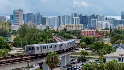
New Tool Puts Miami Development Opportunities on the Map
There's plenty of vacant or underutilized land to be found in Miami-Dade County, if you know where and how to look.

Planetizen Federal Action Tracker
A weekly monitor of how Trump’s orders and actions are impacting planners and planning in America.

Restaurant Patios Were a Pandemic Win — Why Were They so Hard to Keep?
Social distancing requirements and changes in travel patterns prompted cities to pilot new uses for street and sidewalk space. Then it got complicated.

Map: Where Senate Republicans Want to Sell Your Public Lands
For public land advocates, the Senate Republicans’ proposal to sell millions of acres of public land in the West is “the biggest fight of their careers.”

Maui's Vacation Rental Debate Turns Ugly
Verbal attacks, misinformation campaigns and fistfights plague a high-stakes debate to convert thousands of vacation rentals into long-term housing.

San Francisco Suspends Traffic Calming Amidst Record Deaths
Citing “a challenging fiscal landscape,” the city will cease the program on the heels of 42 traffic deaths, including 24 pedestrians.

California Homeless Arrests, Citations Spike After Ruling
An investigation reveals that anti-homeless actions increased up to 500% after Grants Pass v. Johnson — even in cities claiming no policy change.
Urban Design for Planners 1: Software Tools
This six-course series explores essential urban design concepts using open source software and equips planners with the tools they need to participate fully in the urban design process.
Planning for Universal Design
Learn the tools for implementing Universal Design in planning regulations.
Heyer Gruel & Associates PA
JM Goldson LLC
Custer County Colorado
City of Camden Redevelopment Agency
City of Astoria
Transportation Research & Education Center (TREC) at Portland State University
Camden Redevelopment Agency
City of Claremont
Municipality of Princeton (NJ)