


In the Philadelphia region, residents of wealthier neighborhoods will be more likely to work from home in the future, thus altering travel patterns and transit usage, according to a new mapping project powered by artificial intelligence (AI).

"Students from Penn State University's Nittany AI Alliance, in partnership with the City of Philadelphia, the Southeastern Pennsylvania Transportation Authority (SEPTA) and Accenture, have developed an AI-driven algorithm to illustrate the 'teleworking risk' of census tracts across the Philadelphia region," according to an article by Kristin Musulin.
"The algorithm uses American Community Survey data and historical ridership data from SEPTA to indicate the percentage of jobs that can be done by telework in each tract, then displays those percentages in a heat map," according to Musulin.
The interactive SEPTA Future Telework Forecasting Tool allows for layers like bus and train routes to be added to the heat map. The creators of the map hope that the findings of the study can help planners prepare for a future that includes a lot more telework—and all the land use and transportation implications such a shift would entail.
One key characteristic the project reveals about "telework risk," or the potential for large numbers of people to work from home instead of commuting into offices and other workplaces, is that wealthier areas are more likely to see large numbers of people working from home.
FULL STORY: PSU team maps Philadelphia's telework trends

Transit Riders Skipping Mondays
The new commute normal includes far fewer transit rides on Mondays, reflecting new hybrid work schedules that gives workers the options of choosing days to come into the office.

Census Bureau: Remote Work Tripled Between 2019 and 2021
The percentage of Americans working primarily from home tripled to over 27 million people during the pandemic. Will the popularity of remote work last?
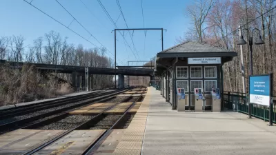
Post-Pandemic Transit Planning: A New Era for Commuter Rail
Ridership on the nation's commuter rail services has plummeted more than other forms of transit during the pandemic. Serving a more affluent, professional ridership, commuter rail is looking more likely to face long-term cuts after the pandemic.

Maui's Vacation Rental Debate Turns Ugly
Verbal attacks, misinformation campaigns and fistfights plague a high-stakes debate to convert thousands of vacation rentals into long-term housing.

Planetizen Federal Action Tracker
A weekly monitor of how Trump’s orders and actions are impacting planners and planning in America.

In Urban Planning, AI Prompting Could be the New Design Thinking
Creativity has long been key to great urban design. What if we see AI as our new creative partner?

King County Supportive Housing Program Offers Hope for Unhoused Residents
The county is taking a ‘Housing First’ approach that prioritizes getting people into housing, then offering wraparound supportive services.

Researchers Use AI to Get Clearer Picture of US Housing
Analysts are using artificial intelligence to supercharge their research by allowing them to comb through data faster. Though these AI tools can be error prone, they save time and housing researchers are optimistic about the future.

Making Shared Micromobility More Inclusive
Cities and shared mobility system operators can do more to include people with disabilities in planning and operations, per a new report.
Urban Design for Planners 1: Software Tools
This six-course series explores essential urban design concepts using open source software and equips planners with the tools they need to participate fully in the urban design process.
Planning for Universal Design
Learn the tools for implementing Universal Design in planning regulations.
planning NEXT
Appalachian Highlands Housing Partners
Mpact (founded as Rail~Volution)
City of Camden Redevelopment Agency
City of Astoria
City of Portland
City of Laramie