


"The city should consider road diets for all streets with excess car capacity, although they're not always politically easy," writes John Greenfield.
"If we want to fight congestion, improve air quality and make our city safer, more prosperous and more livable, we need to get serious about replacing as many car trips as possible with train, bus, bicycle and walking trips," according to a post by John Greenfield for Crain's Chicago Business.
Greenfield bases his argument on the successful early returns form road diets around the city that reconfigured four-lane roads to "two travel lanes and a turn lane, plus bike lanes and wider sidewalks." According to Greenfield, "It's worked on streets like South Chicago Street, 55th Street, Broadway and Lawrence Avenue."
Greenfield provides plenty of data to build a rational case in support of road diets, especially of the variety that will be required for BRT plans in downtown and on Ashland Avenue.
FULL STORY: Let's eliminate the biggest problem on Chicago's streets: Cars

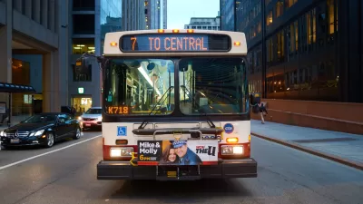
How the Ashland BRT Would Change Chicago
The proposed Ashland Bus Rapid Transit line in Chicago, the latest effort in an ambitious multi-modal transportation investment plan by Mayor Rahm Emanuel and former Chicago DOT Commissioner Gabe Klein, is a game changer for an already unique city.
Chicago Pumps the Brakes on BRT
City officials say funding for dedicated bus lanes could take years, but other improvements could speed up bus service.
Chicago Transit Releases 2024 Budget
The agency projects modest ridership growth while aiming to make long-term investments in bus and rail improvements.

Planetizen Federal Action Tracker
A weekly monitor of how Trump’s orders and actions are impacting planners and planning in America.

Restaurant Patios Were a Pandemic Win — Why Were They so Hard to Keep?
Social distancing requirements and changes in travel patterns prompted cities to pilot new uses for street and sidewalk space. Then it got complicated.

Map: Where Senate Republicans Want to Sell Your Public Lands
For public land advocates, the Senate Republicans’ proposal to sell millions of acres of public land in the West is “the biggest fight of their careers.”

Maui's Vacation Rental Debate Turns Ugly
Verbal attacks, misinformation campaigns and fistfights plague a high-stakes debate to convert thousands of vacation rentals into long-term housing.

San Francisco Suspends Traffic Calming Amidst Record Deaths
Citing “a challenging fiscal landscape,” the city will cease the program on the heels of 42 traffic deaths, including 24 pedestrians.

California Homeless Arrests, Citations Spike After Ruling
An investigation reveals that anti-homeless actions increased up to 500% after Grants Pass v. Johnson — even in cities claiming no policy change.
Urban Design for Planners 1: Software Tools
This six-course series explores essential urban design concepts using open source software and equips planners with the tools they need to participate fully in the urban design process.
Planning for Universal Design
Learn the tools for implementing Universal Design in planning regulations.
Heyer Gruel & Associates PA
JM Goldson LLC
Custer County Colorado
City of Camden Redevelopment Agency
City of Astoria
Transportation Research & Education Center (TREC) at Portland State University
Camden Redevelopment Agency
City of Claremont
Municipality of Princeton (NJ)