


What happens when there is no room to widen a congested roadway? One solution is to build above the roadway. Another, suggests an HNTB expert, would be to convert an existing lane into a managed toll lane and fund transit with the revenue.
"Some of the most chronically congested highways in the Northeast are old legacy roads, which are not tolled and which have no space adjacent to them for building a new toll lane," writes Tom Curry of the Transportation Policy Hub at CQ Roll Call.
One solution was offered by Pennsylvania Secretary of Transportation Barry Schoch who "speculated last year about putting a deck on top of the existing Schuylkill Expressway and offering drivers 'a choice of what they’d be willing to pay, a fee, to get to from King of Prussia to downtown in guaranteed to 20-minute time frame'.”
Other jammed legacy highways throughout the Northeast face the same space constraints as the Schuylkill.
We discussed this with a tolling expert who just moved from California to Arlington, Va., Matthew Click, director of priced managed lanes for HNTB Corporation, a consultant to toll agencies.
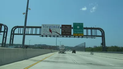
According to Click, "(t)he majority of the priced managed lanes are in Florida, Texas, California and Georgia, and were originally conversions of high occupancy vehicle lanes. In the Washington-New York-Boston corridor, congestion pricing is being used only on I-495 in Virginia."
“Let us take the top ten urban areas, and pilot doing a lane conversion of a GP [general purpose] lane. Let’s put performance measurements around it that it has to meet” and regulation so that the toll revenue “doesn’t cross subsidize a convention center or something.”
Interestingly, he suggests spending toll revenue on bus rapid transit or express buses for the corridor.
What Click does not suggest is adding congestion pricing, where the price increases with the level of congestion, to toll roads with fixed rates.
[Hat tip to Mayer Horn of Univ. of Minnesota's congestion pricing forum]
FULL STORY: Can Congestion Pricing Work Where It’s Needed Most?

Popularity of Express Lanes Spreads Beyond Virginia
Dan Vock of Governing takes a broad look at congestion pricing, beginning with the success of Virginia's 66 Express Lanes, the ones where tolls initially topped $40. Notwithstanding complaints, managed lanes are spreading, but challenges remain.
Will Economists Be the New Highway Men?
Got road congestion? Pricing in the form of managed (don't call them HOT) lanes makes more sense than new construction, according to a panel of transportation experts led by HNTB Corp., reports James Bruckbauer of Michigan Land Use Institute.

It’s Time to Embrace Congestion Pricing
Charging based on demand and for access is commonplace—except on roads.

Maui's Vacation Rental Debate Turns Ugly
Verbal attacks, misinformation campaigns and fistfights plague a high-stakes debate to convert thousands of vacation rentals into long-term housing.

Planetizen Federal Action Tracker
A weekly monitor of how Trump’s orders and actions are impacting planners and planning in America.

In Urban Planning, AI Prompting Could be the New Design Thinking
Creativity has long been key to great urban design. What if we see AI as our new creative partner?

Portland Raises Parking Fees to Pay for Street Maintenance
The city is struggling to bridge a massive budget gap at the Bureau of Transportation, which largely depleted its reserves during the Civd-19 pandemic.

Spokane Mayor Introduces Housing Reforms Package
Mayor Lisa Brown’s proposals include deferring or waiving some development fees to encourage more affordable housing development.

Houston Mayor Kills Another Bike Lane
The mayor rejected a proposed bike lane in the Montrose district in keeping with his pledge to maintain car lanes.
Urban Design for Planners 1: Software Tools
This six-course series explores essential urban design concepts using open source software and equips planners with the tools they need to participate fully in the urban design process.
Planning for Universal Design
Learn the tools for implementing Universal Design in planning regulations.
Gallatin County Department of Planning & Community Development
Heyer Gruel & Associates PA
JM Goldson LLC
City of Camden Redevelopment Agency
City of Astoria
Transportation Research & Education Center (TREC) at Portland State University
Jefferson Parish Government
Camden Redevelopment Agency
City of Claremont