


Instead of density for density's sake (or for smart growth's sake), F. Kaid Benfield argues that the human scale is the key to walkable smart growth.
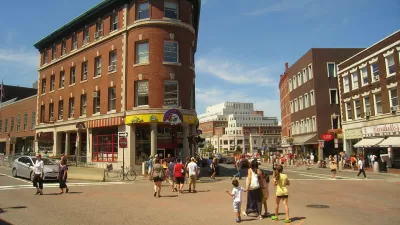
F. Kaid Benfield notices that advocacy groups such as Smart Growth America tend to select pictures of historic, mid-density, mixed-use districts when showing the benefits of walkable, "smart growth" cities. According to Benfield, "We use examples like these to illustrate our advocacy because they represent many of the qualities that newer suburban sprawl lacks but that we would like to see in more urban and suburban neighborhoods: walkability, density, and a diverse mix of uses, to name three."
"But I think there’s more going on than that….I submit that a huge reason why people feel attracted to and comfortable in historic neighborhoods is not just because of their familiarity and walkability but also because they present urban density at a human scale."
Rather than focusing just on density as a panacea for suburban ills, Benfield explains that some benefits of more compact living—such as reductions in impervious pavements (in the transportation network serving sprawl) and the use of cars (in the transportation network serving sprawl)—are found at the "lower end of the density spectrum": "the environmental gains begin to diminish at a density of about 20 homes per acre, and there is little additional benefit to these indicators as density increases beyond about 60 homes per acre."
Instead of density as the measure of smart growth and walkability success, or for density's sake, Benfield suggests that urbanists should consider the human scale as promoted by Jan Gehl as critical to the walkability of neighborhoods.
FULL STORY: Remembering the Human Scale in Walkable City Neighborhoods

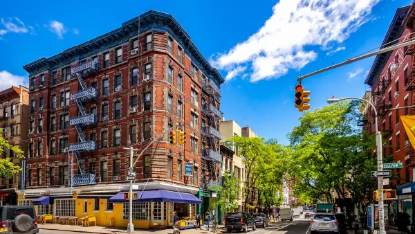
In Dense NYC, What Does ‘Human Scale’ Mean?
Advocates reject the NIMBY label, arguing that they seek a more sustainable, incremental pace of growth modeled on mid-rise neighborhoods.
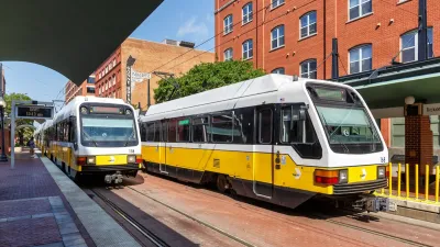
North Texas Transit Leaders Tout Benefits of TOD for Growing Region
At a summit focused on transit-oriented development, policymakers discussed how North Texas’ expanded light rail system can serve as a tool for economic growth.
California Bill Aims to Boost TOD
A bill proposed by Sen. Scott Wiener would exempt transit agencies from zoning rules near ‘high-quality’ transit stops and allow denser transit-oriented development.

Planetizen Federal Action Tracker
A weekly monitor of how Trump’s orders and actions are impacting planners and planning in America.

Map: Where Senate Republicans Want to Sell Your Public Lands
For public land advocates, the Senate Republicans’ proposal to sell millions of acres of public land in the West is “the biggest fight of their careers.”

Restaurant Patios Were a Pandemic Win — Why Were They so Hard to Keep?
Social distancing requirements and changes in travel patterns prompted cities to pilot new uses for street and sidewalk space. Then it got complicated.

Platform Pilsner: Vancouver Transit Agency Releases... a Beer?
TransLink will receive a portion of every sale of the four-pack.

Toronto Weighs Cheaper Transit, Parking Hikes for Major Events
Special event rates would take effect during large festivals, sports games and concerts to ‘discourage driving, manage congestion and free up space for transit.”

Berlin to Consider Car-Free Zone Larger Than Manhattan
The area bound by the 22-mile Ringbahn would still allow 12 uses of a private automobile per year per person, and several other exemptions.
Urban Design for Planners 1: Software Tools
This six-course series explores essential urban design concepts using open source software and equips planners with the tools they need to participate fully in the urban design process.
Planning for Universal Design
Learn the tools for implementing Universal Design in planning regulations.
Heyer Gruel & Associates PA
JM Goldson LLC
Custer County Colorado
City of Camden Redevelopment Agency
City of Astoria
Transportation Research & Education Center (TREC) at Portland State University
Camden Redevelopment Agency
City of Claremont
Municipality of Princeton (NJ)