


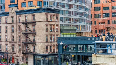
One of Manhattan's most popular tourist attractions, the linear, elevated urban park that existed as a freight rail line as late as 1980, is also a means of commuting to work - but only for walkers as cycling is prohibited along the High Line.
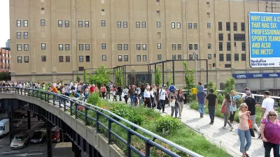
Calling it the High Line's "best-kept secret", Matt Flegenheimer writes, "With no traffic lights, no cars or bikes (prohibited under park rules) and few tourists during the morning rush, the raised stretch has come to attract commuters — not because it is picturesque, but because it is faster."
Flegenheimer timed the High Line commute to walking the same distance at street level, from Gansevoort St. to West 30th, complete with stair-walking to get to/from the elevated park (though elevators do exist). The High Line won by five minutes.
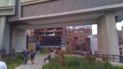
Some Chelsea residents began commuting almost immediately after the park opened, said Robert Hammond, a co-founder of Friends of the High Line. But the number has accelerated since the introduction of Section Two [in December, 2010], he said, with the pathway extended nearer to Midtown residents who work at Google or other companies in Chelsea Market.
The walkway even attracts commuters from outside the area, serving a multi-modal function.
Jane Potenzo, 63, of Port Washington, N.Y., said she typically walked the High Line to reach Chelsea after taking the Long Island Rail Road to Penn Station, hoping to spot foliage coming into or out of bloom. “It’s the best part of my day,” she said.
Unlike a real highway though, the commuters must share the 'roadway' with joggers, parents pushing strollers, picture-takers, and the queues at the coffee-stations along the route.
FULL STORY: High Line’s Best-Kept Secret: It’s a Fast Commute

The All-New High Line
With travel restrictions requiring quarantines for many out-of-state visitors to New York City, the normal hordes of tourists on New York's High Line will be absent for months to come.
Debating the Legacy of the High Line
A new debate has emerged, starting from a source very close to the project, about the effects of the High Line in New York City.
Massive, Expensive Redevelopment of Midtown Manhattan Proposed
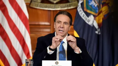
New York Governor Cuomo's State of the State speeches last week included an ambitious proposal for a large-scale redevelopment project on Manhattan's west side, adjacent to Penn Station.

Planetizen Federal Action Tracker
A weekly monitor of how Trump’s orders and actions are impacting planners and planning in America.

Map: Where Senate Republicans Want to Sell Your Public Lands
For public land advocates, the Senate Republicans’ proposal to sell millions of acres of public land in the West is “the biggest fight of their careers.”

Restaurant Patios Were a Pandemic Win — Why Were They so Hard to Keep?
Social distancing requirements and changes in travel patterns prompted cities to pilot new uses for street and sidewalk space. Then it got complicated.

Platform Pilsner: Vancouver Transit Agency Releases... a Beer?
TransLink will receive a portion of every sale of the four-pack.

Toronto Weighs Cheaper Transit, Parking Hikes for Major Events
Special event rates would take effect during large festivals, sports games and concerts to ‘discourage driving, manage congestion and free up space for transit.”

Berlin to Consider Car-Free Zone Larger Than Manhattan
The area bound by the 22-mile Ringbahn would still allow 12 uses of a private automobile per year per person, and several other exemptions.
Urban Design for Planners 1: Software Tools
This six-course series explores essential urban design concepts using open source software and equips planners with the tools they need to participate fully in the urban design process.
Planning for Universal Design
Learn the tools for implementing Universal Design in planning regulations.
Heyer Gruel & Associates PA
JM Goldson LLC
Custer County Colorado
City of Camden Redevelopment Agency
City of Astoria
Transportation Research & Education Center (TREC) at Portland State University
Camden Redevelopment Agency
City of Claremont
Municipality of Princeton (NJ)