


Presenting the case of New York's High Line, student Sahra Mirbabaee questions who benefits from the city's investments.
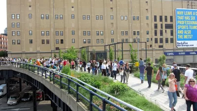
New York City’s 1.45-mile long High Line was a costly public endeavor, Mirbabaee writes. Following the project’s first two installments, which cost a reported $152.3 million, its third is expected to cost an additional $86.2 million. This is to be accompanied by annual operating costs ranging between $2 million -$4 million. For Miarbabaee, however, the public investment – which funded half of the project – has been more than questionable.
Although attracting praise from architects, planners, and visitors alike, the High Line has been a source of considerable trouble for nearby residents. By fueling gentrification, Mirbabaee argues that the project raised living costs in the areas around the High Line and forced many local residents to leave their homes.
For Mirbabaee, there is a “troubling irony” in the project’s aesthetic, which “…exudes a ‘cool’ image of feigned neglect.” “Commodifying ostensibly lower-class spaces for supposedly higher classes,” Mirbabaee continues, “is both patronizing and divisive.”
There is a fundamental need to pose the question of who benefits from the city’s investments, argues Mirbabaee. Given Mayor Bloomberg’s recent proposal to cut $170 million from the city’s childcare services funding, Mirbabaee suspects a case of “disproportionate public investment in real estate”.
“Reversing this misappropriation of funds,” Mirbabaee writes, “would allow us all to build more vibrant neighborhoods than the High Line’s designers could ever have imagined.”
FULL STORY: Poverty below the high line

How to Prevent 'Green Gentrification'
A new report examines a range of strategies that limit the displacement effects of park projects.
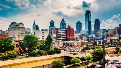
Working to Avoid the Pitfalls of the High Line
A highly anticipated linear park project in Philadelphia will open this year. Planners and activists have been working in anticipation of increased pressure on the local housing market.
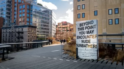
The 'Deliberately Unkind' Public Art of the High Line
"You could be forgiven for reading the art as a message to less-than-opulent New Yorkers: You’ve lost your place," writes Michael Friedman.

Planetizen Federal Action Tracker
A weekly monitor of how Trump’s orders and actions are impacting planners and planning in America.

Map: Where Senate Republicans Want to Sell Your Public Lands
For public land advocates, the Senate Republicans’ proposal to sell millions of acres of public land in the West is “the biggest fight of their careers.”

Restaurant Patios Were a Pandemic Win — Why Were They so Hard to Keep?
Social distancing requirements and changes in travel patterns prompted cities to pilot new uses for street and sidewalk space. Then it got complicated.

Platform Pilsner: Vancouver Transit Agency Releases... a Beer?
TransLink will receive a portion of every sale of the four-pack.

Toronto Weighs Cheaper Transit, Parking Hikes for Major Events
Special event rates would take effect during large festivals, sports games and concerts to ‘discourage driving, manage congestion and free up space for transit.”

Berlin to Consider Car-Free Zone Larger Than Manhattan
The area bound by the 22-mile Ringbahn would still allow 12 uses of a private automobile per year per person, and several other exemptions.
Urban Design for Planners 1: Software Tools
This six-course series explores essential urban design concepts using open source software and equips planners with the tools they need to participate fully in the urban design process.
Planning for Universal Design
Learn the tools for implementing Universal Design in planning regulations.
Heyer Gruel & Associates PA
JM Goldson LLC
Custer County Colorado
City of Camden Redevelopment Agency
City of Astoria
Transportation Research & Education Center (TREC) at Portland State University
Camden Redevelopment Agency
City of Claremont
Municipality of Princeton (NJ)