


As St. Louis and Portland speed along with new streetcar developments, Yonah Freemark considers how zoning may determine the success of one, and the failure of another.
Cities across the United States are looking to streetcars as development tools first, and transportation systems second. But, as The Transport Politic's Yonah Freemark reports, some cities are overlooking the need to modify zoning for parcels adjacent to streetcar stations to allow and incentivize the development they're hoping for.
Comparing new streetcar lines in Portland and St. Louis, some surprising differences emerge. On some of St. Louis' most transit-accessible lots, for example, "...buildings cannot exceed three stories or 45 to 50 feet," reports Freemark. "Meanwhile, non-pedestrian-oriented uses, such as drive-through restaurants, are allowed to be constructed. For residential buildings, developers are required to provide parking for one car per unit, and commercial structures over a size limit must provide parking as well."
For comparison, "[w]ith the densities allowed in Portland, significant new construction in the Eastside areas will be possible," says Freemark. Portland can also expect to see an increased downtown population and lower automobile usage, a result of the streetcar and relaxed zoning standards.
FULL STORY: Don’t Forget the Zoning

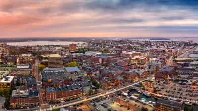
Portland, Maine to Revise Zoning Code
The ReCode initiative promotes more diverse housing types and reduces parking requirements, among other changes.

Portland Council to Consider Zoning Amendments
The proposed zoning and land use changes would offer bigger incentives for developers of ‘moderately priced’ housing and relax some restrictions that builders say drive up the cost of construction.

Uncertain Future of Portland’s Neighborhood Associations Causing Controversy
A proposal to dissolve the groups has led to a debate about their purpose and who really benefits from them.

Planetizen Federal Action Tracker
A weekly monitor of how Trump’s orders and actions are impacting planners and planning in America.

Map: Where Senate Republicans Want to Sell Your Public Lands
For public land advocates, the Senate Republicans’ proposal to sell millions of acres of public land in the West is “the biggest fight of their careers.”

Restaurant Patios Were a Pandemic Win — Why Were They so Hard to Keep?
Social distancing requirements and changes in travel patterns prompted cities to pilot new uses for street and sidewalk space. Then it got complicated.

Platform Pilsner: Vancouver Transit Agency Releases... a Beer?
TransLink will receive a portion of every sale of the four-pack.

Toronto Weighs Cheaper Transit, Parking Hikes for Major Events
Special event rates would take effect during large festivals, sports games and concerts to ‘discourage driving, manage congestion and free up space for transit.”

Berlin to Consider Car-Free Zone Larger Than Manhattan
The area bound by the 22-mile Ringbahn would still allow 12 uses of a private automobile per year per person, and several other exemptions.
Urban Design for Planners 1: Software Tools
This six-course series explores essential urban design concepts using open source software and equips planners with the tools they need to participate fully in the urban design process.
Planning for Universal Design
Learn the tools for implementing Universal Design in planning regulations.
Heyer Gruel & Associates PA
JM Goldson LLC
Custer County Colorado
City of Camden Redevelopment Agency
City of Astoria
Transportation Research & Education Center (TREC) at Portland State University
Camden Redevelopment Agency
City of Claremont
Municipality of Princeton (NJ)