


After decades of planning, a 20-mile light rail line in Honolulu is set to begin construction this March, despite persistent concerns over the project's cost.
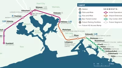
"A 40-year battle to build a mass transit line appears to be nearing its end. Barring a court intervention, construction is to begin in March on a 20-mile rail line that will be elevated 40 feet in the air, barreling over farmland, commercial districts and parts of downtown Honolulu, and stretching from here to Waikiki.
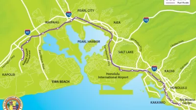
The two-track line -a 30-foot-wide span, with 21 elevated stations - is designed to accommodate an increasing crush of commuters and tourists while encouraging new growth and development, particularly on this undeveloped part of the island. The Honolulu rail project, scheduled for completion in 2018, seems certain to change sharply the nature of much of the south side of the island, as well as downtown Honolulu.
The project has drawn fierce opposition from many environmentalists and some community leaders, who describe it as a concrete gash across green Oahu that will blight pristine coastlines and farmland at the western end and throw a shadow over city streets in Honolulu. It could still be delayed or frozen by a pending suit in federal court from opponents who assert that planners failed to properly explore alternatives to the project in environmental studies."
The light rail is coming on line at a time when traffic and growth are increasingly noticeable in this once-small town. But despite the growing need for new transportation options, some are still opposed to the project's $5.3 billion cost.
Thanks to Nate Berg
FULL STORY: After 40-Year Battle, Train May Roll for Oahu

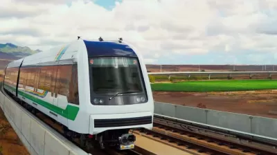
Skyline Rail, Now Serving Honolulu
In a historic day for public transit, Skyline Rail, a project once deemed the worst transit project in the United States due to extreme cost overruns and construction delays, finally opened to the public at the end of June.
Honolulu Light Rail to Open in June
The city’s first light rail line will finally begin service after more than a half century of planning.
Honolulu Rail Cost Overruns Now Exceed $1 Billion
Add another $200 million to the $910 million shortfall already facing Honolulu's rail project. The changing circumstances surrounding the project won't make it any easier to create a viable funding plan to make up the difference.

Planetizen Federal Action Tracker
A weekly monitor of how Trump’s orders and actions are impacting planners and planning in America.

Map: Where Senate Republicans Want to Sell Your Public Lands
For public land advocates, the Senate Republicans’ proposal to sell millions of acres of public land in the West is “the biggest fight of their careers.”

Restaurant Patios Were a Pandemic Win — Why Were They so Hard to Keep?
Social distancing requirements and changes in travel patterns prompted cities to pilot new uses for street and sidewalk space. Then it got complicated.

DC Area County Eliminates Bus Fares
Montgomery County joins a growing trend of making transit free.

Platform Pilsner: Vancouver Transit Agency Releases... a Beer?
TransLink will receive a portion of every sale of the four-pack.

Toronto Weighs Cheaper Transit, Parking Hikes for Major Events
Special event rates would take effect during large festivals, sports games and concerts to ‘discourage driving, manage congestion and free up space for transit.”
Urban Design for Planners 1: Software Tools
This six-course series explores essential urban design concepts using open source software and equips planners with the tools they need to participate fully in the urban design process.
Planning for Universal Design
Learn the tools for implementing Universal Design in planning regulations.
Heyer Gruel & Associates PA
JM Goldson LLC
Custer County Colorado
City of Camden Redevelopment Agency
City of Astoria
Transportation Research & Education Center (TREC) at Portland State University
Camden Redevelopment Agency
City of Claremont
Municipality of Princeton (NJ)