


A recent report argues that tolls could provide the solution to Seattle's traffic congestion, but they would have to be very high, and very widely used.
"Widespread tolls could make chronic traffic congestion in Seattle and other cities "a thing of the past," a pioneering study says."
"Tolls could cut the average late-afternoon commute time from downtown Seattle to Tacoma by perhaps 40 percent. A typical rush-hour drive from Bellevue to Lynnwood could be trimmed by more than one-third, the Puget Sound Regional Council's 'Traffic Choices' report concludes."
"But those results would be achieved only by imposing tolls on a scale never attempted anywhere before."
"Drivers would pay a toll on almost every mile they drive - every freeway, every significant arterial. Global Positioning System (GPS) and cellular technology would track their travels. Tolls would be deducted from prepaid accounts."
FULL STORY: Wide use of tolls could unclog roads, Seattle study says

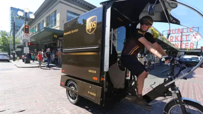
Cargo Bike Pilot Reduces Emissions by 30%
The program deployed electric cargo bikes in a small Seattle neighborhood to test the effectiveness of replacing delivery trucks with lighter vehicles in the last mile of delivery.
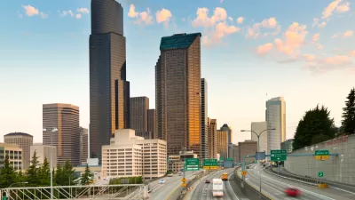
I-5 Widening Kicks Off in Downtown Seattle
Congestion relief is promised as the Washington Department of Transportation begins to rework the existing I-5 roadway in Downtown Seattle to mitigate a stretch of freeway with a reputation as the state's worst bottleneck.
Seattle Emerges From Tolled Tunnel Unscathed
Promises of congestion and thousands of cars spilling on to quiet residential streets proved unfounded after the first week with tolls on the Highway 91 tunnel in Seattle.

Planetizen Federal Action Tracker
A weekly monitor of how Trump’s orders and actions are impacting planners and planning in America.

Map: Where Senate Republicans Want to Sell Your Public Lands
For public land advocates, the Senate Republicans’ proposal to sell millions of acres of public land in the West is “the biggest fight of their careers.”

Restaurant Patios Were a Pandemic Win — Why Were They so Hard to Keep?
Social distancing requirements and changes in travel patterns prompted cities to pilot new uses for street and sidewalk space. Then it got complicated.

Platform Pilsner: Vancouver Transit Agency Releases... a Beer?
TransLink will receive a portion of every sale of the four-pack.

Toronto Weighs Cheaper Transit, Parking Hikes for Major Events
Special event rates would take effect during large festivals, sports games and concerts to ‘discourage driving, manage congestion and free up space for transit.”

Berlin to Consider Car-Free Zone Larger Than Manhattan
The area bound by the 22-mile Ringbahn would still allow 12 uses of a private automobile per year per person, and several other exemptions.
Urban Design for Planners 1: Software Tools
This six-course series explores essential urban design concepts using open source software and equips planners with the tools they need to participate fully in the urban design process.
Planning for Universal Design
Learn the tools for implementing Universal Design in planning regulations.
Heyer Gruel & Associates PA
JM Goldson LLC
Custer County Colorado
City of Camden Redevelopment Agency
City of Astoria
Transportation Research & Education Center (TREC) at Portland State University
Camden Redevelopment Agency
City of Claremont
Municipality of Princeton (NJ)