


The city council will vote on a proposal to lower speed limits to 25 miles per hour to improve safety and make downtown more walkable and welcoming to pedestrians.
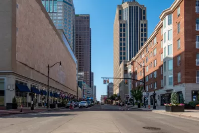
Downtown Columbus could see its speed limit lowered to 25 miles per hour if the city council approves a proposal at this Tuesday’s meeting, reports Mark Ferenchik in The Columbus Dispatch.
According to Ferenchik, “The Downtown streets where speed limits would be limited to 25 mph are in an area bounded by Interstate 670 to the north, Interstate 71 to the east, Interstates 70 and 71 to the south, and the Scioto River and Neil Avenue to the west,” as well as part of the Scioto Peninsula.
The new rule would lower the speed limit from 35 miles per hour, a decrease that is shown to drastically reduce the risk of serious injury and death in crashes involving pedestrians. “Officials in Austin, Texas, studied intersections in that city where similar changes were made and found an 18% reduction year-to-year in the number of pedestrians hit by left-turning vehicles at Downtown intersections.” The plan must be approved by the Ohio Department of Transportation (ODOT) to move forward.
As part of its Vision Zero goal, the city also plans to adjust traffic light timing to slow traffic and change light timing at some intersections to give pedestrians a head start when crossing. The changes would align with the strategic plan developed by the Columbus Downtown Development Corporation, which calls for a more walkable downtown.
FULL STORY: Columbus City Council considers setting speed limit on all Downtown streets at 25 mph


Pittsburgh Agencies Collaborate on Vision Zero Projects
The city reduced pedestrian deaths to seven in 2023.

Chicago Could Join Other Cities in Lowering Speed Limits
Lowering speed limits by just 10 miles per hour can have a major impact on traffic safety.
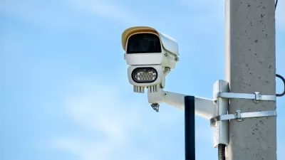
Philly Speed Camera Program Cuts Fatalities in Half
Excessive speeding along dangerous segments of Roosevelt Boulevard dropped by 90 percent after the city installed automated enforcement cameras.

Planetizen Federal Action Tracker
A weekly monitor of how Trump’s orders and actions are impacting planners and planning in America.

Congressman Proposes Bill to Rename DC Metro “Trump Train”
The Make Autorail Great Again Act would withhold federal funding to the system until the Washington Metropolitan Area Transit Authority (WMATA), rebrands as the Washington Metropolitan Authority for Greater Access (WMAGA).

DARTSpace Platform Streamlines Dallas TOD Application Process
The Dallas transit agency hopes a shorter permitting timeline will boost transit-oriented development around rail stations.

Renters Now Outnumber Homeowners in Over 200 US Suburbs
High housing costs in city centers and the new-found flexibility offered by remote work are pushing more renters to suburban areas.

The Tiny, Adorable $7,000 Car Turning Japan Onto EVs
The single seat Mibot charges from a regular plug as quickly as an iPad, and is about half the price of an average EV.

Supreme Court Ruling in Pipeline Case Guts Federal Environmental Law
The decision limits the scope of a federal law that mandates extensive environmental impact reviews of energy, infrastructure, and transportation projects.
Urban Design for Planners 1: Software Tools
This six-course series explores essential urban design concepts using open source software and equips planners with the tools they need to participate fully in the urban design process.
Planning for Universal Design
Learn the tools for implementing Universal Design in planning regulations.
Municipality of Princeton
Roanoke Valley-Alleghany Regional Commission
City of Mt Shasta
City of Camden Redevelopment Agency
City of Astoria
Transportation Research & Education Center (TREC) at Portland State University
US High Speed Rail Association
City of Camden Redevelopment Agency
Municipality of Princeton (NJ)