


A plan to completely overhaul the streets of London will require a "monumental" effort by all residents of the city, according to the mayor of London.
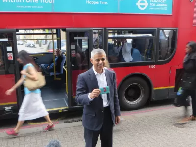
"The Mayor of London, Sadiq Khan, and Transport for London (TfL) have today announced plans to transform parts of central London into one of the largest car-free zones in any capital city in the world," according to a press release front he mayor's office.
According to the press release, the plan has a dual benefit: making it easier to maintain social distance, and improving the air quality in the city.
As for the physical changes proposed by the mayor, the press release describes several tiers of vehicle restrictions and pedestrian and bike priority:
Some streets will be converted to walking and cycling only, with others restricted to all traffic apart from buses, as part of the Mayor’s latest bold Streetspace measures. Streets between London Bridge and Shoreditch, Euston and Waterloo and Old Street and Holborn may be limited to buses, pedestrians and cyclists to help boost safe and sustainable travel as our city starts to gradually emerge from national Covid-19 restrictions. Access for emergency services and disabled people will be maintained, but deliveries on some streets may need to be made outside of congestion charging hours.
As noted in the press release, the car-free planning in response to the public health crisis of the coronavirus also reinstates the city's congestion charge, low emissions zone, and ultra low emissions zone programs.
FULL STORY: Car-free zones in London as Congestion Charge and ULEZ reinstated


Traffic Reductions in Outer London's 'Mini-Hollands' Curtail Vehicle Ownership
An analysis of areas designated as "low traffic neighborhoods" shows a decrease in vehicle ownership rates, a promising sign for the traffic-choked metropolis.

Study: London ULEZ Rapidly Cleaning up Air Pollution
Expanding the city’s ultra low-emission zone has resulted in dramatic drops in particle emissions in inner and outer London.

Study: Poor Air Quality Fuels COVID Transmission
Communities exposed to higher levels of air pollution experience higher rates of infection, particularly in areas with high population density.

Planetizen Federal Action Tracker
A weekly monitor of how Trump’s orders and actions are impacting planners and planning in America.

Congressman Proposes Bill to Rename DC Metro “Trump Train”
The Make Autorail Great Again Act would withhold federal funding to the system until the Washington Metropolitan Area Transit Authority (WMATA), rebrands as the Washington Metropolitan Authority for Greater Access (WMAGA).

DARTSpace Platform Streamlines Dallas TOD Application Process
The Dallas transit agency hopes a shorter permitting timeline will boost transit-oriented development around rail stations.

San Francisco's School District Spent $105M To Build Affordable Housing for Teachers — And That's Just the Beginning
SFUSD joins a growing list of school districts using their land holdings to address housing affordability challenges faced by their own employees.

Car-Centric LA Suburb Looks to a Train-Oriented Future
City leaders in Rancho Cucamonga, the future western terminus of the Brightline West rail line to Las Vegas, want to reimagine the city as a transit-oriented, pedestrian-friendly community.

New Alaska Bitcoin Mine Would Burn as Much Energy as the State’s Largest Coal Plant
Fueled by “stranded” natural gas, the startup hopes to become the largest in the US, and to make Alaska an industry center.
Urban Design for Planners 1: Software Tools
This six-course series explores essential urban design concepts using open source software and equips planners with the tools they need to participate fully in the urban design process.
Planning for Universal Design
Learn the tools for implementing Universal Design in planning regulations.
Municipality of Princeton
Roanoke Valley-Alleghany Regional Commission
City of Mt Shasta
City of Camden Redevelopment Agency
City of Astoria
Transportation Research & Education Center (TREC) at Portland State University
US High Speed Rail Association
City of Camden Redevelopment Agency
Municipality of Princeton (NJ)