


The CityLab team has created a new metric to measure the U.S. cities where people are most likely to be car free.
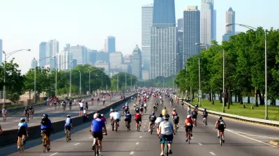
Richard Florida and Charlotta Mellander created a new Metro Car-Free Index that measures the U.S. cities where people go car free in the largest numbers.
According to Florida, who writes to promote the index on CityLab, the index measures:
- The share of households that don’t have access to their own vehicle.
- The share of commuters who take transit to work.
- The share of commuters who bike to work.
- The share of commuters who walk to work.
Florida applies the index as an indicator of where it's easiest to go car free, listed by metro size. The duo's analysis also included a basic correlation analysis to identify the key characteristics associated with car-free metros. "The popularity of living without a car is only weakly related to population and density (with correlations of around .2)," according to Florida.
"Going car-free is much more closely related to America’s economic and political divides," adds Florida, so demographic factors like educational attainment, political affiliation. Florida concludes by noting another key factor in determining a car-free lifestyle: "Ironically, despite the expense of owning a car, going carless in America often requires having money. It helps if you can afford living close to where you work or near good transit, or in a walkable neighborhood with most of life’s necessities close by."
FULL STORY: The Best and Worst U.S. Places to Live Car-Free


Fewer New Yorkers Riding Bikes
A recent report presents evidence that fewer New Yorkers are choosing bikes as an alternative form of transportation.

The Cost of Driving Increasingly Out of Reach in the U.S.
New research stresses the importance of socioeconomic differences in U.S. transportation trends.
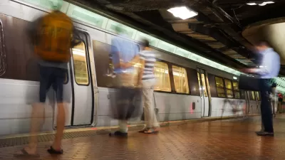
Report: D.C. Area Commuters Driving Alone Less
With all the bad news about plummeting ridership as the D.C. Metro transit system has struggled to deal with maintenance issues, a new report indicates that regional commuters are still driving alone less.

Planetizen Federal Action Tracker
A weekly monitor of how Trump’s orders and actions are impacting planners and planning in America.

San Francisco's School District Spent $105M To Build Affordable Housing for Teachers — And That's Just the Beginning
SFUSD joins a growing list of school districts using their land holdings to address housing affordability challenges faced by their own employees.

The Tiny, Adorable $7,000 Car Turning Japan Onto EVs
The single seat Mibot charges from a regular plug as quickly as an iPad, and is about half the price of an average EV.

Seattle's Plan for Adopting Driverless Cars
Equity, safety, accessibility and affordability are front of mind as the city prepares for robotaxis and other autonomous vehicles.

As Trump Phases Out FEMA, Is It Time to Flee the Floodplains?
With less federal funding available for disaster relief efforts, the need to relocate at-risk communities is more urgent than ever.

With Protected Lanes, 460% More People Commute by Bike
For those needing more ammo, more data proving what we already knew is here.
Urban Design for Planners 1: Software Tools
This six-course series explores essential urban design concepts using open source software and equips planners with the tools they need to participate fully in the urban design process.
Planning for Universal Design
Learn the tools for implementing Universal Design in planning regulations.
Smith Gee Studio
City of Charlotte
City of Camden Redevelopment Agency
City of Astoria
Transportation Research & Education Center (TREC) at Portland State University
US High Speed Rail Association
City of Camden Redevelopment Agency
Municipality of Princeton (NJ)