


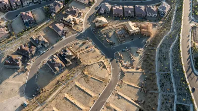
"Neighborhoods at Risk" offers new tools for illustrating the threats posed to communities by climate change.

Headwaters Economics has published a new climate planning tool called "neighborhoods at Risk," which offers a simple way to layer information on to maps of neighborhoods and cities for a better understanding the intermixing social, economic, and environmental factors.
According to the website announcing Neighborhoods at Risk:
Neighborhoods at Risk is web-based, free, and designed to meet multiple local planning needs. The data and maps are useful for prioritizing capital improvements and conducting vulnerability assessments, which can be powerful tools that shape land use, policy, and planning decisions. Applications include FEMA Hazard Mitigation Plans and Carbon Disclosure Project (CDP) reporting.
Supplementing the interactive mapping tool are reports on at-risk demographic populations and potential economic outcomes of climate change. The tool is currently active for 18 U.S. cities, with an expansion to all U.S. cities planned for the future.
FULL STORY: Neighborhoods at Risk


A New Resilience Strategy for Toronto
Toronto is preparing for the worst of climate change, but also the stresses of affordability, congestion, and aging infrastructure.

FEMA Resilience Program Cuts Grant Funding
The Building Resilient Infrastructure and Communities program funded projects from flood prevention to power station upgrades.
Report Outlines Strategies for Resilient Wildfire Recovery in LA
Project Recovery offers a roadmap for rebuilding more sustainable and climate-resilient communities after wildfires and other disasters.

Planetizen Federal Action Tracker
A weekly monitor of how Trump’s orders and actions are impacting planners and planning in America.

San Francisco's School District Spent $105M To Build Affordable Housing for Teachers — And That's Just the Beginning
SFUSD joins a growing list of school districts using their land holdings to address housing affordability challenges faced by their own employees.

The Tiny, Adorable $7,000 Car Turning Japan Onto EVs
The single seat Mibot charges from a regular plug as quickly as an iPad, and is about half the price of an average EV.

Seattle's Plan for Adopting Driverless Cars
Equity, safety, accessibility and affordability are front of mind as the city prepares for robotaxis and other autonomous vehicles.

As Trump Phases Out FEMA, Is It Time to Flee the Floodplains?
With less federal funding available for disaster relief efforts, the need to relocate at-risk communities is more urgent than ever.

With Protected Lanes, 460% More People Commute by Bike
For those needing more ammo, more data proving what we already knew is here.
Urban Design for Planners 1: Software Tools
This six-course series explores essential urban design concepts using open source software and equips planners with the tools they need to participate fully in the urban design process.
Planning for Universal Design
Learn the tools for implementing Universal Design in planning regulations.
Smith Gee Studio
City of Charlotte
City of Camden Redevelopment Agency
City of Astoria
Transportation Research & Education Center (TREC) at Portland State University
US High Speed Rail Association
City of Camden Redevelopment Agency
Municipality of Princeton (NJ)