


The city of Las Vegas is experimenting with a new traffic management partnership that will add traffic cameras and sensors to the streets in its innovation district.
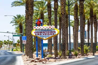
The city of Las Vegas recently announced plans to roll out video cameras and sound sensors to improve traffic management in an area of the city’s Innovation District, reports Chris Teale.
The new traffic management technology is made possible through a partnership between the city, the state government of Nevada, and Japanese company Nippon Telegraph and Telephone Corporation (NTT).
A press release announcing the partnership explains more details about how the new technology will work:
Designed to improve safety, the proof of concept provides information to City personnel to help increase situation awareness and provide a foundation to traffic management and mobility that will create future economic opportunities. NTT Group deployed high-definition video cameras, sound sensors, as well as IoT devices to monitor a geographic area within the city’s Innovation District.
City officials are saying the effort furthers its Innovate.Vegas initiative, "which looks to concentrate smart city technology in Vegas’ downtown core and looks to serve as the home of autonomous vehicles (AVs), partnerships with ride-hailing and mobility companies and other initiatives," according to Teale.
FULL STORY: Las Vegas to roll out sensors, cameras to aid traffic management


NYC Congestion Pricing Continues to Show Positive Results
While the Trump administration attempts to revoke the program’s federal approval, congestion pricing continues to reduce traffic, speed up bus travel times, and improve air quality in Manhattan.
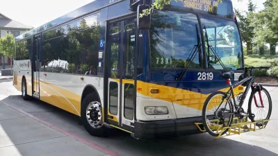
Sacramento Leads Nation With Bus-Mounted Bike Lane Enforcement Cameras
The city is the first to use its bus-mounted traffic enforcement system to cite drivers who park or drive in bike lanes.
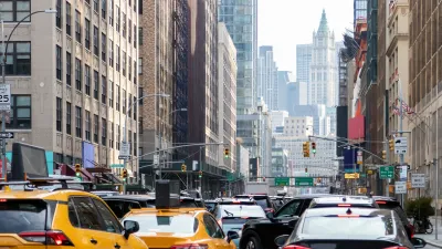
Agreement Keeps NYC Congestion Pricing Alive Through Summer
The tolling program will continue while a court considers the city’s lawsuit against the Trump administration.

Planetizen Federal Action Tracker
A weekly monitor of how Trump’s orders and actions are impacting planners and planning in America.

San Francisco's School District Spent $105M To Build Affordable Housing for Teachers — And That's Just the Beginning
SFUSD joins a growing list of school districts using their land holdings to address housing affordability challenges faced by their own employees.

The Tiny, Adorable $7,000 Car Turning Japan Onto EVs
The single seat Mibot charges from a regular plug as quickly as an iPad, and is about half the price of an average EV.

Seattle's Plan for Adopting Driverless Cars
Equity, safety, accessibility and affordability are front of mind as the city prepares for robotaxis and other autonomous vehicles.

As Trump Phases Out FEMA, Is It Time to Flee the Floodplains?
With less federal funding available for disaster relief efforts, the need to relocate at-risk communities is more urgent than ever.

With Protected Lanes, 460% More People Commute by Bike
For those needing more ammo, more data proving what we already knew is here.
Urban Design for Planners 1: Software Tools
This six-course series explores essential urban design concepts using open source software and equips planners with the tools they need to participate fully in the urban design process.
Planning for Universal Design
Learn the tools for implementing Universal Design in planning regulations.
Smith Gee Studio
City of Charlotte
City of Camden Redevelopment Agency
City of Astoria
Transportation Research & Education Center (TREC) at Portland State University
US High Speed Rail Association
City of Camden Redevelopment Agency
Municipality of Princeton (NJ)