


The Hop will deliver new transit service on the east side of downtown Milwaukee. The Hop comes also serves big development expectations from local officials.
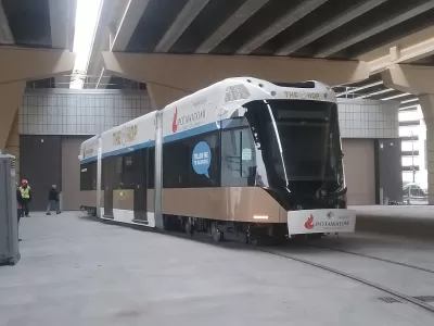
"The first public rides on The Hop were on time and began with a bit of a jolt and a whiff of new car smell Monday," reports James B. Nelson.
Journalists and city officials got a first look at the new streetcar a few days before the city's new streetcar line opened to the public on November 2.
Mayor Tom Barrett was on the ride earlier this week, touting the streetcar as a development and property tax catalyst for the city. "The mayor ticked off numerous commercial developments along the route, including the new 25-story BMO Tower office being built at 790 North Water St. and revamping of the Milwaukee Athletic Club, 758 North Broadway," according to Nelson.
A separate article by Nelson lists the essential facts about the new streetcar system. "On Friday, the $124 million Milwaukee streetcar officially becomes part of the transportation landscape," writes Nelson. "[A] 2.5-mile network of tracks and overhead wires has been laid and five 67-foot cars delivered. The Hop will run on a loop through downtown and the Historic Third Ward between the Milwaukee Intermodal Station, 433 W. St. Paul Ave., and Burns Commons, at East Ogden and North Prospect avenues."
More info in the article includes The Hop's route, its intended ridership, the political context that produced the final product (and a planned extension), and the benchmarks of success, once the system has some miles under its belt.
FULL STORY: Everything you need to know about the new Milwaukee streetcar, at least for now

Progress Slow for Milwaukee's Streetcar Extension
Milwaukee's mayor has a $160 million plan to extend The Hop streetcar, but the proposal so far lacks the necessary political support.
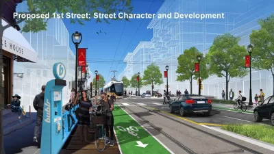
Land Use Planning Precedes Streetcar Extension in Milwaukee
Plans to extend Milwaukee's The Hop streetcar line are still years away from fruition, but the city is already at work on development plans to make the most of the opportunity.
St. Paul-Mall of America Streetcar Connection Moving Forward
The Riverview transit corridor has plenty of local support. Now planners will get to work.

Maui's Vacation Rental Debate Turns Ugly
Verbal attacks, misinformation campaigns and fistfights plague a high-stakes debate to convert thousands of vacation rentals into long-term housing.

Planetizen Federal Action Tracker
A weekly monitor of how Trump’s orders and actions are impacting planners and planning in America.

In Urban Planning, AI Prompting Could be the New Design Thinking
Creativity has long been key to great urban design. What if we see AI as our new creative partner?

Florida Seniors Face Rising Homelessness Risk
High housing costs are pushing more seniors, many of them on a fixed income, into homelessness.

Massachusetts Budget Helps Close MBTA Budget Gap
The budget signed by Gov. Maura Healey includes $470 million in MBTA funding for the next fiscal year.

Milwaukee Launches Vision Zero Plan
Seven years after the city signed its Complete Streets Policy, the city is doubling down on its efforts to eliminate traffic deaths.
Urban Design for Planners 1: Software Tools
This six-course series explores essential urban design concepts using open source software and equips planners with the tools they need to participate fully in the urban design process.
Planning for Universal Design
Learn the tools for implementing Universal Design in planning regulations.
Gallatin County Department of Planning & Community Development
Heyer Gruel & Associates PA
JM Goldson LLC
City of Camden Redevelopment Agency
City of Astoria
Transportation Research & Education Center (TREC) at Portland State University
Jefferson Parish Government
Camden Redevelopment Agency
City of Claremont