


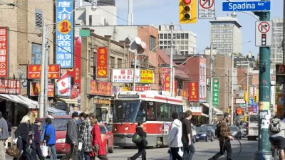
Simply put, this scholar says, it comes down to race. With far fewer non-white urban residents, Canadian cities didn't fall prey to the redlining, white flight, and incarceration problems that so heavily impacted cities like Detroit.

According to Jason Hackworth, a professor of urban geography at the University of Toronto, there's one big difference why cities like Detroit suffered while Canadian cities like Toronto did not, despite their similar economies.
John Gallagher writes, "The more [Hackworth] looked, the more one big difference between Canada and the United States emerged: It came down to race. Put simply, U.S. cities tend to have large black and other non-white populations and Canadian cities do not." In U.S. cities, an influx of non-whites led to a white backlash, encompassing flight to the suburbs, redlining, biased criminal justice practices, and the like. Compounded with economic decline, those factors landed cities like Detroit in deep trouble.
Historical Canadian policy, on the other hand, "made sure black and other non-white populations remained small. Restrictive covenants in real estate sales, and an immigration policy that specifically gave preference to white people, kept the black population small."
Gallagher concludes, "Simply put, in Canada, white people never felt as threatened by a rising non-white population because there just weren't that many non-whites coming into cities like Windsor or Toronto. Hence, no Detroits in Canada."
FULL STORY: Why Canadian cities didn't suffer as Detroit did

New Research Shows Toronto Highly Segregated Along Race and Class Lines
A closer look at the numbers reveals stark divides among Toronto neighborhoods.
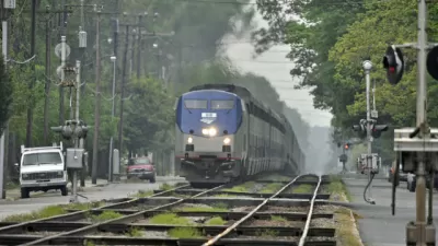
Railroad Merger Would Add Service Between Detroit and Toronto
An agreement between two rail companies would create a connection between Michigan and Ontario, improve passenger rail service in the Midwest, and add new lines in Louisiana and Texas.
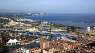
Cleveland Has Yet to Recover From the Last Recession
Decades of racist policy and a lack of critical resources have left Cleveland in a perpetual state of economic fragility. The city can't afford another recession.

Planetizen Federal Action Tracker
A weekly monitor of how Trump’s orders and actions are impacting planners and planning in America.

DARTSpace Platform Streamlines Dallas TOD Application Process
The Dallas transit agency hopes a shorter permitting timeline will boost transit-oriented development around rail stations.

Congressman Proposes Bill to Rename DC Metro “Trump Train”
The Make Autorail Great Again Act would withhold federal funding to the system until the Washington Metropolitan Area Transit Authority (WMATA), rebrands as the Washington Metropolitan Authority for Greater Access (WMAGA).

Supreme Court Ruling in Pipeline Case Guts Federal Environmental Law
The decision limits the scope of a federal law that mandates extensive environmental impact reviews of energy, infrastructure, and transportation projects.

Texas State Bills to Defund Dallas Transit Die
DART would have seen a 30% service cut, $230M annual losses had the bills survived.

Bikeshare for the Win: Team Pedals to London Cricket Match, Beats Rivals Stuck in Traffic
While their opponents sat in gridlock, England's national cricket team hopped Lime bikes, riding to a 3-0 victory.
Urban Design for Planners 1: Software Tools
This six-course series explores essential urban design concepts using open source software and equips planners with the tools they need to participate fully in the urban design process.
Planning for Universal Design
Learn the tools for implementing Universal Design in planning regulations.
City of Mt Shasta
City of Camden Redevelopment Agency
City of Astoria
Transportation Research & Education Center (TREC) at Portland State University
US High Speed Rail Association
City of Camden Redevelopment Agency
Municipality of Princeton (NJ)