


The new sales tax will fund improved bus service, rapid transit projects, and ‘transit -supportive’ infrastructure.
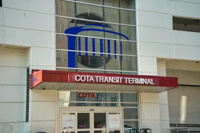
Voters in central Ohio approved a half percent sales tax increase to fund improved bus service, bus rapid transit (BRT), and new sidewalks and bike paths.
As Jordan Laird notes in The Columbus Dispatch, “The levy permanently renews an existing 0.25% sales tax and adds another 0.5% sales tax. Combined with another 0.25% sales tax levy that is not on the ballot, approval of this levy brings COTA's total share of sales tax to 1% and Franklin County's total sales tax to 8%.” Roughly 57 percent of Franklin County voters approved the measure as of November 5.
The funding will allow the Central Ohio Transit Authority (COTA) to build the region’s first bus rapid transit (BRT) lines, increase bus service by 45 percent, and build over 500 miles of new sidewalks, bike paths, and trails by 2050. The LinkUS plan includes five rapid transit lines, with at least three planned as BRT. While light rail is not currently in the plan, officials say they have not ruled it out. COTA will also expand on-demand transit service zones, add late-night bus service, and build “transit-supportive infrastructure.”
Residents should start seeing improvements in service frequency and hours next year.
FULL STORY: Sales tax set to go up in central Ohio after voters give green light to COTA levy

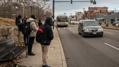
Boston’s Blue Hill Avenue to Get BRT, Safety Improvements
The key bus corridor serves over 37,000 bus riders daily.
Texas Bill Would Ban Road Diets, Congestion Pricing
A Texas state senator wants to prevent any discussion of congestion pricing and could suspend existing bike lane and sidewalk projects.
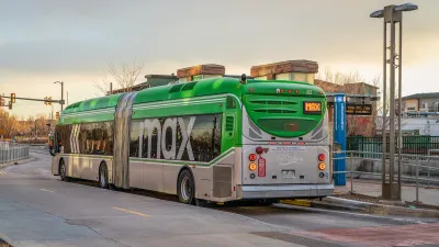
Colorado Lawmakers Move to Protect BRT Funding
In the face of potential federal funding cuts, CDOT leaders reasserted their commitment to planned bus rapid transit projects.

Planetizen Federal Action Tracker
A weekly monitor of how Trump’s orders and actions are impacting planners and planning in America.

Restaurant Patios Were a Pandemic Win — Why Were They so Hard to Keep?
Social distancing requirements and changes in travel patterns prompted cities to pilot new uses for street and sidewalk space. Then it got complicated.

Map: Where Senate Republicans Want to Sell Your Public Lands
For public land advocates, the Senate Republicans’ proposal to sell millions of acres of public land in the West is “the biggest fight of their careers.”

Maui's Vacation Rental Debate Turns Ugly
Verbal attacks, misinformation campaigns and fistfights plague a high-stakes debate to convert thousands of vacation rentals into long-term housing.

San Francisco Suspends Traffic Calming Amidst Record Deaths
Citing “a challenging fiscal landscape,” the city will cease the program on the heels of 42 traffic deaths, including 24 pedestrians.

California Homeless Arrests, Citations Spike After Ruling
An investigation reveals that anti-homeless actions increased up to 500% after Grants Pass v. Johnson — even in cities claiming no policy change.
Urban Design for Planners 1: Software Tools
This six-course series explores essential urban design concepts using open source software and equips planners with the tools they need to participate fully in the urban design process.
Planning for Universal Design
Learn the tools for implementing Universal Design in planning regulations.
Heyer Gruel & Associates PA
JM Goldson LLC
Custer County Colorado
City of Camden Redevelopment Agency
City of Astoria
Transportation Research & Education Center (TREC) at Portland State University
Camden Redevelopment Agency
City of Claremont
Municipality of Princeton (NJ)