


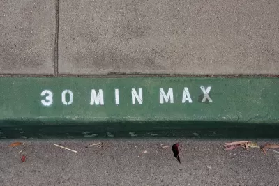
Curb monitoring technology is helping cities build a growing understanding of the shifting demand for this valuable urban space.
More cities are viewing their curbs as “part of a digital system to support parking, deliveries and the changing dynamic of urban life,” writes Skip Descant in Govtech.
Using technology to monitor curb usage is helping cities implement dynamic parking pricing that adjusts to demand to manage available parking space and evaluate the best uses for curbside space.
Portland, Oregon and Santa Monica, California are both testing ‘zero-emission delivery zones,’ areas in the central business districts of each city that prioritize access for zero-emission delivery vehicles. According to Descant, “Portland officials will learn about the city’s curbs via the curb analytics data collected. A portion of this data will enable them to visualize the operations of B-Line, the micro-freight operator, in the same way Portland already visualizes micromobility data.”
San Jose, California plans to use digital curb data to create its own dynamic parking pricing program. In San Francisco, officials are working to catalog physical street assets such as signage and bus stops in the same platform as curb space and parking spots to create a comprehensive directory of city assets that can help inform policy decisions.
FULL STORY: Digital Curb Data Deepens Understanding of Urban Activity


State of Curbs & Parking Report Reveals Glut of Data
As the uses of curb space become more diverse, city officials are working to understand how to best manage this increasingly important urban amenity.
Opinion: Chicago Needs an Office of Parking Management
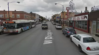
The city of Chicago needs a local agency empowered to planning, studying, or managing parking, according to a recent opinion piece published by Streetsblog Chicago.

Motorists Sue Chicago Parking Meter Operator
A lawsuit claims a company's 75-year contract to manage the city of Chicago's parking meters amounts to an "unreasonable" monopoly.

Planetizen Federal Action Tracker
A weekly monitor of how Trump’s orders and actions are impacting planners and planning in America.

Congressman Proposes Bill to Rename DC Metro “Trump Train”
The Make Autorail Great Again Act would withhold federal funding to the system until the Washington Metropolitan Area Transit Authority (WMATA), rebrands as the Washington Metropolitan Authority for Greater Access (WMAGA).

The Simple Legislative Tool Transforming Vacant Downtowns
In California, Michigan and Georgia, an easy win is bringing dollars — and delight — back to city centers.

The States Losing Rural Delivery Rooms at an Alarming Pace
In some states, as few as 9% of rural hospitals still deliver babies. As a result, rising pre-term births, no adequate pre-term care and harrowing close calls are a growing reality.

The Small South Asian Republic Going all in on EVs
Thanks to one simple policy change less than five years ago, 65% of new cars in this Himalayan country are now electric.

DC Backpedals on Bike Lane Protection, Swaps Barriers for Paint
Citing aesthetic concerns, the city is removing the concrete barriers and flexposts that once separated Arizona Avenue cyclists from motor vehicles.
Urban Design for Planners 1: Software Tools
This six-course series explores essential urban design concepts using open source software and equips planners with the tools they need to participate fully in the urban design process.
Planning for Universal Design
Learn the tools for implementing Universal Design in planning regulations.
Smith Gee Studio
City of Charlotte
City of Camden Redevelopment Agency
City of Astoria
Transportation Research & Education Center (TREC) at Portland State University
US High Speed Rail Association
City of Camden Redevelopment Agency
Municipality of Princeton (NJ)