


The new tool highlights the streets that pose the biggest risk to pedestrians and other road users.

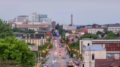
Officials in Louisville, Kentucky have a new tool to assess which local roads are in need of safety improvements as part of its Vision Zero effort to elimiate traffic deaths, reports Jacob Munoz for Louisville Public Media. “More than 900 people died in Louisville from surface road crashes from 2016-23, and nearly 4,200 others were suspected to have been seriously injured in collisions.”
“Louisville Metro Government’s Vision Zero initiative, which aims to strengthen traffic safety, released its first High Injury Network map in January. The tool provides a priority list of 53 corridors that officials can consider for safety improvements.” The roads in the network make up 5 percent of non-interstate miles in the city, but experience over half of fatal and serious injury crashes. “Most of the high-risk roads identified on the map are state-owned, meaning the Kentucky Transportation Cabinet would need to sign off on improvement projects,” Munoz adds. The city says the map is already helping guide decisions on infrastructure improvements.
FULL STORY: Louisville’s High Injury Network could help prioritize improving safety on certain roads

Milwaukee Launches Vision Zero Plan
Seven years after the city signed its Complete Streets Policy, the city is doubling down on its efforts to eliminate traffic deaths.
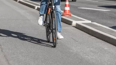
Southeast LA Road Safety Advocates Call for Improved Infrastructure
Streets in southeastern Los Angeles County have a severe lack of protected bike lanes and traffic safety measures, leading to high numbers of fatalities in a community where many residents depend on walking and biking for daily needs.

Jacksonville Takes Action on Vision Zero
The city is implementing its first-ever Vision Zero Action Plan in an effort to reduce pedestrian and cyclist deaths and serious injuries.

Maui's Vacation Rental Debate Turns Ugly
Verbal attacks, misinformation campaigns and fistfights plague a high-stakes debate to convert thousands of vacation rentals into long-term housing.

Planetizen Federal Action Tracker
A weekly monitor of how Trump’s orders and actions are impacting planners and planning in America.

In Urban Planning, AI Prompting Could be the New Design Thinking
Creativity has long been key to great urban design. What if we see AI as our new creative partner?

Milwaukee Launches Vision Zero Plan
Seven years after the city signed its Complete Streets Policy, the city is doubling down on its efforts to eliminate traffic deaths.

Portland Raises Parking Fees to Pay for Street Maintenance
The city is struggling to bridge a massive budget gap at the Bureau of Transportation, which largely depleted its reserves during the Civd-19 pandemic.

Spokane Mayor Introduces Housing Reforms Package
Mayor Lisa Brown’s proposals include deferring or waiving some development fees to encourage more affordable housing development.
Urban Design for Planners 1: Software Tools
This six-course series explores essential urban design concepts using open source software and equips planners with the tools they need to participate fully in the urban design process.
Planning for Universal Design
Learn the tools for implementing Universal Design in planning regulations.
Gallatin County Department of Planning & Community Development
Heyer Gruel & Associates PA
JM Goldson LLC
City of Camden Redevelopment Agency
City of Astoria
Transportation Research & Education Center (TREC) at Portland State University
Jefferson Parish Government
Camden Redevelopment Agency
City of Claremont