


The program will mark the first use of automated enforcement to ticket vehicles blocking access to bus stops.
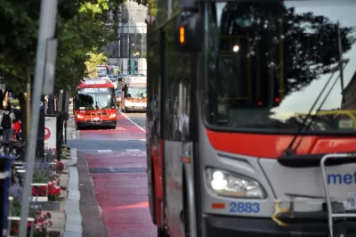
Washington, D.C. will use bus-mounted cameras to issue citations to drivers who block bus lanes and bus stops, reports Jordan Pascale in DCist. “The goal is to reduce trip times, decrease operator stress, increase schedule adherence and reliability and improve bus stop accessibility. Metro says 64% of D.C. bus riders would see better service because of the bus lane enforcement.” According to Pascale, keeping bus lanes clear could speed up average bus speeds in the District from 10 miles per hour to 20 miles per hour.
The program will make Metro and the District Department of Transportation the first agencies to use cameras to ticket drivers for blocking bus stops, meaning a bus can’t approach as closely as it should. Four buses used as part of a test run each captured 60 violations daily. “The camera-equipped buses will first be rolled out on 31 routes that travel through bus lane areas like H and I streets NW in downtown, 14th Street in Columbia Heights, 16th Street NW, M Street SE, Martin Luther King Avenue SE, Pennsylvania Avenue S.E., and Minnesota Avenue S.E.”
The District has seen success with other automated traffic enforcement cameras that ticket drivers for speeding and other violations. However, there has also been a rise in fake or obscured license plates that limits the efficacy of camera enforcement programs.
FULL STORY: D.C. Will Use Cameras To Ticket Drivers In Bus Lanes, At Bus Stops For First Time

D.C. Delays Bus Lane Enforcement
The program using cameras to ticket drivers who block bus lanes was scheduled to begin this week.
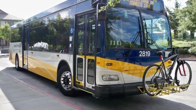
Sacramento Leads Nation With Bus-Mounted Bike Lane Enforcement Cameras
The city is the first to use its bus-mounted traffic enforcement system to cite drivers who park or drive in bike lanes.
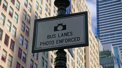
NYC Camera Program Captures 400,000 Bus Lane Violations
Bus speeds increased by as much as 25 percent on some routes after enforcement began last August.

Planetizen Federal Action Tracker
A weekly monitor of how Trump’s orders and actions are impacting planners and planning in America.

Map: Where Senate Republicans Want to Sell Your Public Lands
For public land advocates, the Senate Republicans’ proposal to sell millions of acres of public land in the West is “the biggest fight of their careers.”

Restaurant Patios Were a Pandemic Win — Why Were They so Hard to Keep?
Social distancing requirements and changes in travel patterns prompted cities to pilot new uses for street and sidewalk space. Then it got complicated.

Platform Pilsner: Vancouver Transit Agency Releases... a Beer?
TransLink will receive a portion of every sale of the four-pack.

Toronto Weighs Cheaper Transit, Parking Hikes for Major Events
Special event rates would take effect during large festivals, sports games and concerts to ‘discourage driving, manage congestion and free up space for transit.”

Berlin to Consider Car-Free Zone Larger Than Manhattan
The area bound by the 22-mile Ringbahn would still allow 12 uses of a private automobile per year per person, and several other exemptions.
Urban Design for Planners 1: Software Tools
This six-course series explores essential urban design concepts using open source software and equips planners with the tools they need to participate fully in the urban design process.
Planning for Universal Design
Learn the tools for implementing Universal Design in planning regulations.
Heyer Gruel & Associates PA
JM Goldson LLC
Custer County Colorado
City of Camden Redevelopment Agency
City of Astoria
Transportation Research & Education Center (TREC) at Portland State University
Camden Redevelopment Agency
City of Claremont
Municipality of Princeton (NJ)