


The Bi-State Development Agency received roughly $7.4 million for efforts to expand the city’s MetroLink train system.
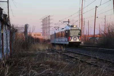
“About $7.4 million in federal pandemic aid allotted to the Bi-State Development Agency will pay for the next round of planning for a potential expansion of MetroLink” in St. Louis, according to an article by Mark Schlinkmann in the St. Louis Post-Dispatch. “Taulby Roach, the agency’s CEO, said the next phase would include seeking public opinion on the possible stations along the revised route for the line, which would run along Jefferson Avenue from Chippewa Street to the National Geospatial-Intelligence Agency headquarters.”
The estimated cost for the project is $850 million. “Information developed in the next phase of planning will be used to base an application to the federal government for 60% of the project cost,” Schlinkmann writes. “Meanwhile, St. Louis County and AECOM are researching a potential extension of the city’s northside-southside line into North County. Four alternative routes were announced last month.”
FULL STORY: Federal pandemic aid to pay for next round of planning for MetroLink expansion

Mass Transit Wins Big in St. Louis County
A half-cent sales tax increase to fund transit passed handily yesterday in St. Louis County, Missouri.

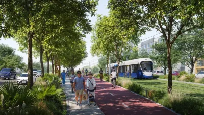
Passengers Flock to Caltrain After Electrification
The new electric trains are running faster and more reliably, leading to strong ridership growth on the Bay Area rail system.
Austin’s Project Connect Funding Safe for 2025
The light rail project is moving ahead with plans to finalize its environmental impact review by late 2025.

Planetizen Federal Action Tracker
A weekly monitor of how Trump’s orders and actions are impacting planners and planning in America.

Map: Where Senate Republicans Want to Sell Your Public Lands
For public land advocates, the Senate Republicans’ proposal to sell millions of acres of public land in the West is “the biggest fight of their careers.”

Restaurant Patios Were a Pandemic Win — Why Were They so Hard to Keep?
Social distancing requirements and changes in travel patterns prompted cities to pilot new uses for street and sidewalk space. Then it got complicated.

Platform Pilsner: Vancouver Transit Agency Releases... a Beer?
TransLink will receive a portion of every sale of the four-pack.

Toronto Weighs Cheaper Transit, Parking Hikes for Major Events
Special event rates would take effect during large festivals, sports games and concerts to ‘discourage driving, manage congestion and free up space for transit.”

Berlin to Consider Car-Free Zone Larger Than Manhattan
The area bound by the 22-mile Ringbahn would still allow 12 uses of a private automobile per year per person, and several other exemptions.
Urban Design for Planners 1: Software Tools
This six-course series explores essential urban design concepts using open source software and equips planners with the tools they need to participate fully in the urban design process.
Planning for Universal Design
Learn the tools for implementing Universal Design in planning regulations.
Heyer Gruel & Associates PA
JM Goldson LLC
Custer County Colorado
City of Camden Redevelopment Agency
City of Astoria
Transportation Research & Education Center (TREC) at Portland State University
Camden Redevelopment Agency
City of Claremont
Municipality of Princeton (NJ)