


While many American cities rely on vehicle counts to make transportation planning decisions, most haven’t prioritized counting bikes, leading to underinvestment in bike infrastructure.
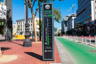
“Countless American cities have invested in networks of car counters, whose infamous ‘level of service’ data transportation leaders often use to justify dubious lane expansion projects on the busiest segments of their road networks.” But as Kea Wilson points out in Greater Greater Washington, many fewer cities have invested in resources for counting bicyclists. “That means that dynamic changes in ridership caused by easily fixable problems can go totally unnoticed until a resident makes a report — and even basic, critical metrics, like how likely pedestrians are to be killed in a fatal crash per miles traveled, aren’t analyzed at all.”
“In a recent paper for the National Institute for Transportation and Communities, researchers took a close look at the shockingly nascent science of bicycle counting and how cities could do a better job of measuring where its residents ride.” Unlike other research on the topic, the study combined a variety of data sources—physical counters, voluntary monitoring apps like Strava, bike share data, and cell phone data—to estimate bike counts in six cities.
Its authors caution that no one method accurately represents the number of bikes circulating in a city, so investing in a combination of sources is the only way to attempt a more accurate count. Lead author Sirisha Kothuri “particularly recommends that policymakers go after any available grant money they can find to invest in automatic bicycle counters in addition to big data services, validate and maintain those static counters rigorously, and place them thoughtfully throughout the community, not just on the recreational trails where counters are most likely to record big numbers.”
FULL STORY: Why cities need to do a better job of counting bicyclists

Why Bike Lanes Are Good: An Explainer for the US Transportation Secretary
Sean Duffy says there’s no evidence that bike lanes have benefits. Streetsblog — and federal agencies’ own data — beg to differ.
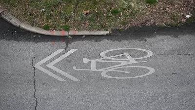
Sharrows Are Ineffective, Potentially Counterproductive
Research shows there’s no substitute for protected bike lanes, and sharrows may make roads more dangerous for cyclists.
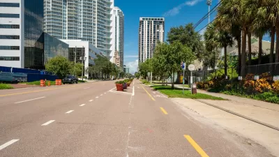
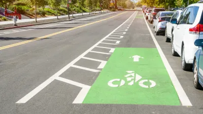
St. Petersburg’s Bike Infrastructure Efforts Pay Off
New bike infrastructure is encouraging more people to take to the streets on two wheels, but advocates say safety challenges remain.

Planetizen Federal Action Tracker
A weekly monitor of how Trump’s orders and actions are impacting planners and planning in America.

Map: Where Senate Republicans Want to Sell Your Public Lands
For public land advocates, the Senate Republicans’ proposal to sell millions of acres of public land in the West is “the biggest fight of their careers.”

Restaurant Patios Were a Pandemic Win — Why Were They so Hard to Keep?
Social distancing requirements and changes in travel patterns prompted cities to pilot new uses for street and sidewalk space. Then it got complicated.

Platform Pilsner: Vancouver Transit Agency Releases... a Beer?
TransLink will receive a portion of every sale of the four-pack.

Toronto Weighs Cheaper Transit, Parking Hikes for Major Events
Special event rates would take effect during large festivals, sports games and concerts to ‘discourage driving, manage congestion and free up space for transit.”

Berlin to Consider Car-Free Zone Larger Than Manhattan
The area bound by the 22-mile Ringbahn would still allow 12 uses of a private automobile per year per person, and several other exemptions.
Urban Design for Planners 1: Software Tools
This six-course series explores essential urban design concepts using open source software and equips planners with the tools they need to participate fully in the urban design process.
Planning for Universal Design
Learn the tools for implementing Universal Design in planning regulations.
Heyer Gruel & Associates PA
JM Goldson LLC
Custer County Colorado
City of Camden Redevelopment Agency
City of Astoria
Transportation Research & Education Center (TREC) at Portland State University
Camden Redevelopment Agency
City of Claremont
Municipality of Princeton (NJ)