


Want to know which streets are most likely to produce a negative emotional response among Seattle transportation safety advocates? Read on.
Charles Mudede produces an emotional cartography of the worst streets in Seattle,
Mudede explains how Galvanic Skin Response (GSR) technology, which combines cellphone and lie detector technologies to track social-emotional responses to the city, revolutionized the practice of psychogeography. Mudede credits artist, designer, and psychogeographer Christian Nold with the use of GSR o produce social-emotional maps of cities.
The article, however, relies on expert opinion, rather than GSR, to call out the five streets in Seattle that sharply increase negative feelings.
Topping Mudede's list is Rainier Avenue, which Seattle Greenways cited as the worst street in the city, "hands down." The head of the Transit Riders Union, local reporter Ryan Packer, and even the Seattle Department of Transportation's Twitter feed are called in corroborate that assessment.
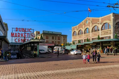
Also included on the list are Pike Place at Pike Place Market (!!), 15th Ave NW, Denny Way, and Martin Luther King Jr Way.
FULL STORY: The Seattle Streets We Really Hate

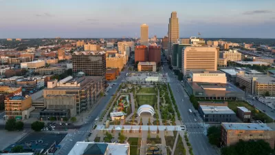
Downtown Omaha Planning for its Post-One-Way-Streets Era
The Omaha City Council has decided to reverse the transportation model adopted in the city in the 1950s, for the benefit of traffic safety and local retail activity.

Planning for Congestion Relief
The third and final installment of Planetizen's examination of the role of the planning profession in both perpetuating and solving traffic congestion.
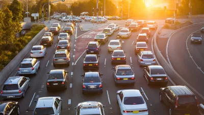
How Planning Fails to Solve Congestion
Solutions for congestion are never as simple and easy as armchair planners and engineers would like you to believe—especially those who suggest that congestion can be solved by forever building more roadway capacity.

Planetizen Federal Action Tracker
A weekly monitor of how Trump’s orders and actions are impacting planners and planning in America.

Restaurant Patios Were a Pandemic Win — Why Were They so Hard to Keep?
Social distancing requirements and changes in travel patterns prompted cities to pilot new uses for street and sidewalk space. Then it got complicated.

Map: Where Senate Republicans Want to Sell Your Public Lands
For public land advocates, the Senate Republicans’ proposal to sell millions of acres of public land in the West is “the biggest fight of their careers.”

Maui's Vacation Rental Debate Turns Ugly
Verbal attacks, misinformation campaigns and fistfights plague a high-stakes debate to convert thousands of vacation rentals into long-term housing.

San Francisco Suspends Traffic Calming Amidst Record Deaths
Citing “a challenging fiscal landscape,” the city will cease the program on the heels of 42 traffic deaths, including 24 pedestrians.

California Homeless Arrests, Citations Spike After Ruling
An investigation reveals that anti-homeless actions increased up to 500% after Grants Pass v. Johnson — even in cities claiming no policy change.
Urban Design for Planners 1: Software Tools
This six-course series explores essential urban design concepts using open source software and equips planners with the tools they need to participate fully in the urban design process.
Planning for Universal Design
Learn the tools for implementing Universal Design in planning regulations.
Heyer Gruel & Associates PA
JM Goldson LLC
Custer County Colorado
City of Camden Redevelopment Agency
City of Astoria
Transportation Research & Education Center (TREC) at Portland State University
Camden Redevelopment Agency
City of Claremont
Municipality of Princeton (NJ)